Namibia, Windhoek
course-v1:ETH+FC-01x+2019_T1 - online.ethz.ch-f325011c0e43425c9a316b67eec107c3
Uploaded on 2025-05-01 by Henk Pretorius Malherbe
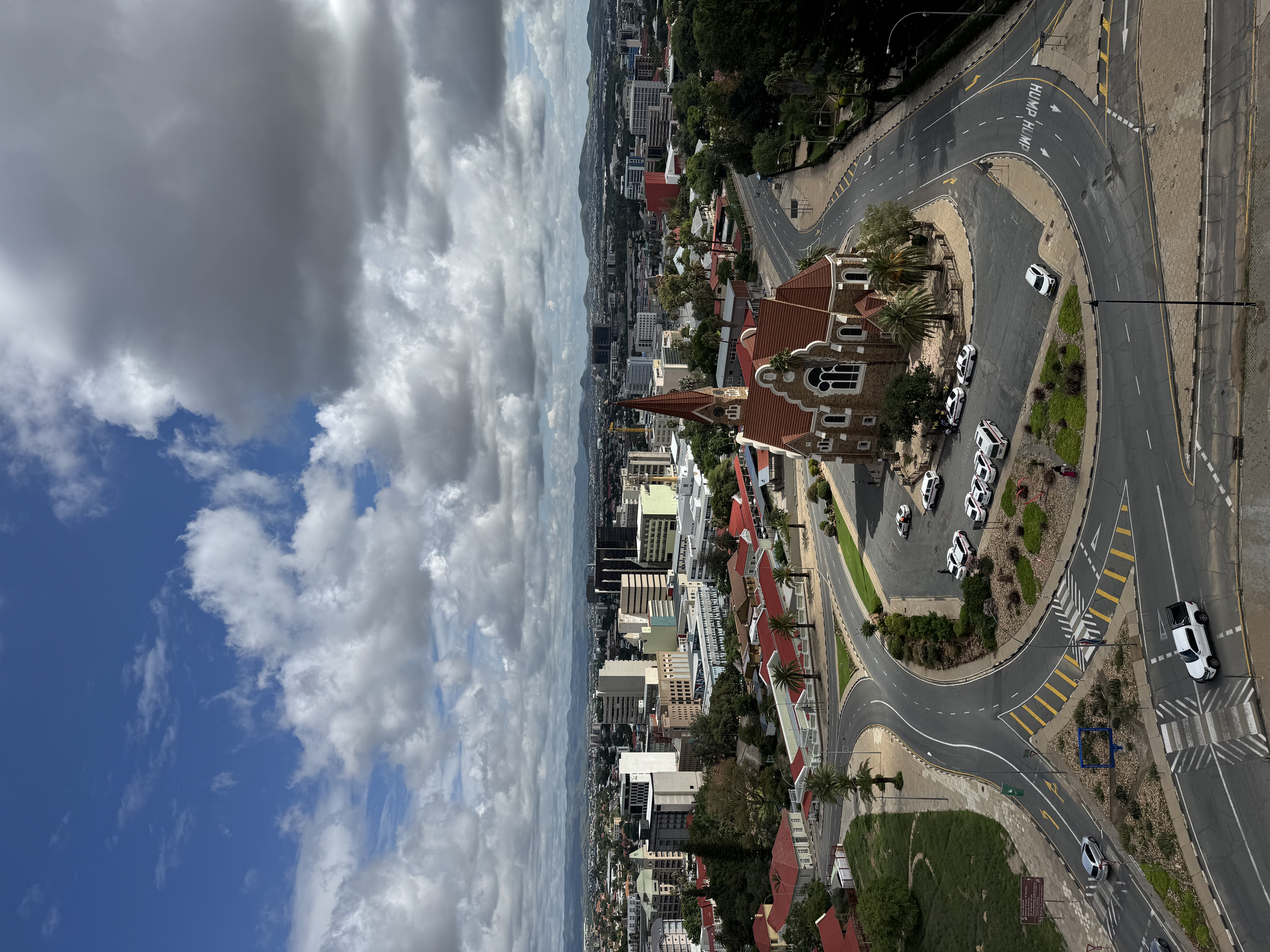
In this image of the city of Windhoek, taken from the rooftop of the Independence Museum, there's a number of visible informational cues about the city: 1. Wide roads and roundabout 2. Numerous parked cars, no busses, bicycles, or trains 3. Limited traffic calming measures 4. Minimal pedestrian pathways (narrow and fragmented) 5. Lack of shade 6. No benches, water fountains, or rest areas 7. Green space seems decorative, not functional The two invisible information points I can extract out of the visible information on this image is the following: 1. Inequality and Segregation - Those who can’t afford cars face physical barriers, (e.g., heat, distance, lack of shade) the urban design prioritizes people with economic means over the majority who may rely on walking or public transport. 2. Weakened Civil Society - No support of gathering - no features accommodate people with limited mobility (children/elderly/disabled) - no walkable experiences, people don't develop emotional ties to the historic architecture. By uncovering invisible information, such as patterns of disconnection, exclusion, and spatial inequality, urban planners can transform it into actionable knowledge that guides the creation of more inclusive, walkable, and socially cohesive urban environments.