Colombia, Cali
FC-01x Future Cities (Self-Paced) - Exercise 1 : "Making the Invisible - Visible"

Uploaded on 2016-09-25 by Juan Camilo Guarin Peñaranda
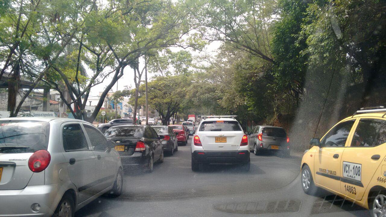
Info about the photo and context: It was taken in Cali - Colombia, by me Juan Camilo Guarin P., in a place called Ciudad Jardín (Garden City). It is one of the most beautiful neighborhoods in the south of the city, and it is very near to almost all the universities and private schools. Of course, having a bad distribution of schools and universities across the city (having them located very near to each other) makes this beautiful neighborhood a mess on rush hour. But, problems don't end there, because there is a tremendous lack of infrastructure for bycicles and platforms for the people to walk. For the people who live here, having a car is very important because walking or going on bike is very dangerous. The cars go very fast, and people in Colombia drive very riskfully. I must say this is not a bad place of the city. In fact, in this neighborhood are located some of the most expensive shops and houses in Cali. Even though, the lack of infrastructure not only damages the quality of life of all the people who live there, but, the quality of life of all the students, teachers, workers, and others, that, like me, have to go through this pain everyday. 1) In this picture, you can see a big line of cars. This story is repeated everyday in this neighborhood due to several reasons, including the exposed above. Also, you can see that cars are taking 3 lines of the road, but you should know that one of them is exclusively for bikes. The lack of culture of the people who drive makes biking in this zone very uncomfortable. Walking is also a big challenge on this zone, because, as you can see in the image, at the right side of the street there is no platform for the people. It is not noticeable in this image, but, at the left side of the street there is also no platform for the people. So, people who could walk instead of using their car don't do it because they have to walk directly on the street, and as I have said before, people here drive very riskfully. Another thing to notice from this image is that there is a straight line of cars that seems to never end. If I could show you more pictures, you would see that through this big line there are no zebras, traffic lights, or any other option to let people cross from one side of the street to the other. So, in this very large line of cars there is no safe way for people to cross the street without having to run to avoid being hit by a car. Of course there are many other things I could tell you about this picture, but one I would like you to notice is that you cannot see any bus, tram or trolley working. This is because in this zone only the bus work, but its service is very bad. In fact, in Cali, only buses work despite having more than 2 million people. (This is another big problem in itself) 2) I would extract the measure of how many cars go by this street everyday and how many people must go to study or work on the universities and schools located in this zone everyday. I think there are other things to take into account. For example, measure how many people actually live here, how many bikers use this street and how many people walk here. 3) I would like to explain more about why I choose 'how many people must go to study or work on the universities and schools located in this zone everyday' as a way this invisible information can become knowledge and contribute to the planning of a more liveable urban space. I select it because I think having a real measure of how many students, teachers and workers go to their universities using the public transportation system, or go by car, by bycicle, or walking, could give the administration knowledge of how people actually move through this zone. This could then contribute to the planning of a more liveable urban space if the administration made studies of how building platforms, bike lanes and maybe connecting all this zone with a tram could not only move more people, but make this place more beautiful, more accessible and liveable for the great amount of people who must go through it everyday. Having this knowledge would help know what is the first step towards the benefit of all the community.