Canada, Toronto
FC-01x Future Cities (Self-Paced) - Exercise 1 : "Making the Invisible - Visible"

Uploaded on 2020-05-12 by Ian
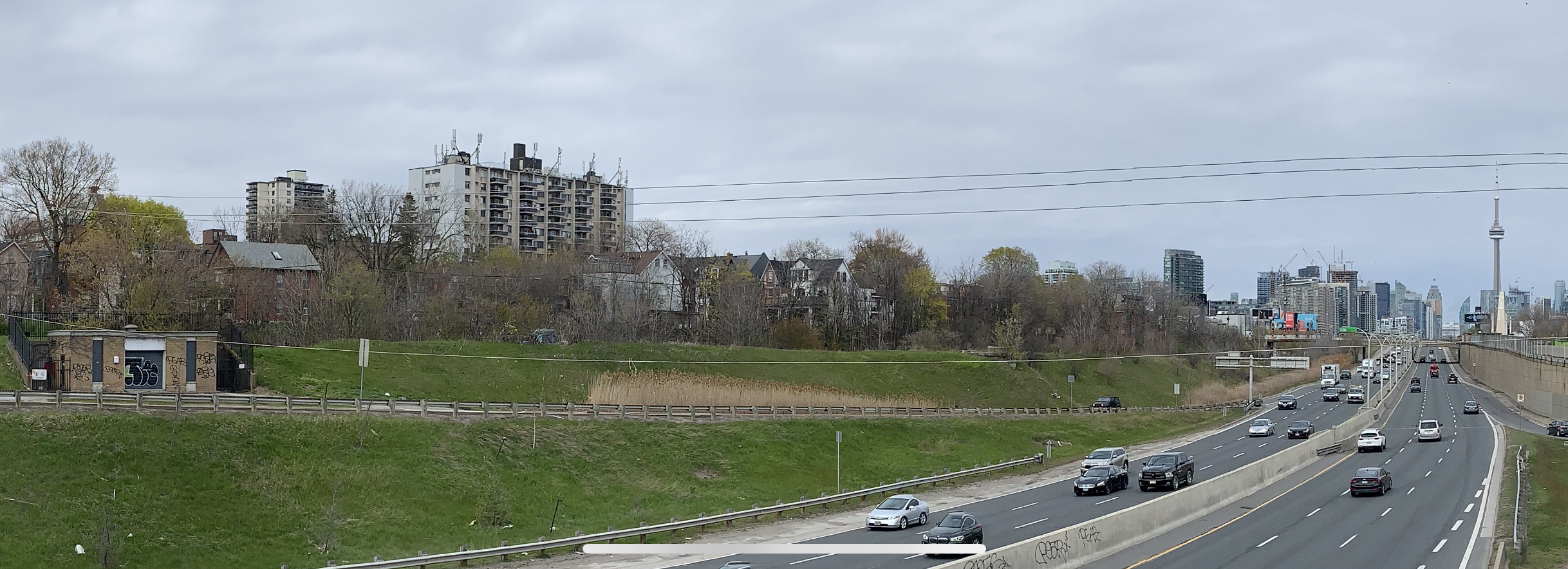
I want to focus my attentions on the Toronto neighbourhood of Parkdale, on the southwest side of the city. It seems like a bland image to discuss an urban neighbourhood, but there's a lot at play here. It was once a low-income neighbourhood, but has gentrified intensely over the past decade. You can see by the CN tower (right), its close proximity to the downtown core. The highway, that cuts the southern portion of the city, separates residential neighbourhoods from the waterfront directly behind the camera. The highway below is an extremely busy inner-city highway. Talks about tolling / limiting car access to the city and increasing train traffic are common, in order to encourage commuters to use public transit and keep cars out of the downtown core. The grassy area beyond the highway is commonly used as a homeless tent city, though routinely cleared out by authorities. You can see one of the affordable housing developments nestled behind the large Victorian homes, which are often the subject of rent strikes to slumlords, extend in high density beyond the picture to the left. The large homes have all inflated in price to a point unattainable by the neighbourhood's residents.