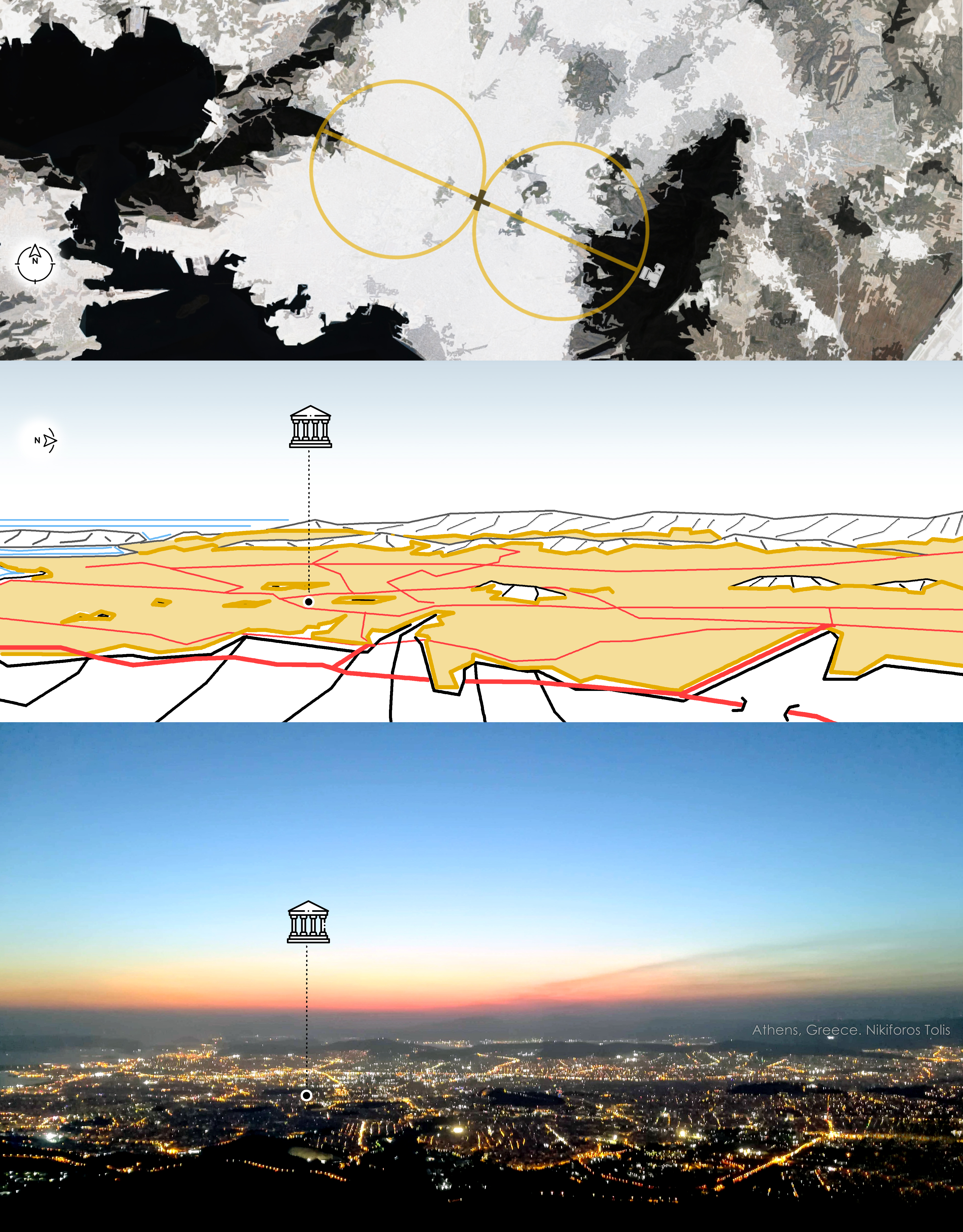
Greece, Athens
FC-01x Future Cities (Self-Paced) - Exercise 1 : "Making the Invisible - Visible"

Uploaded on 2019-04-02 by Nikiforos Tolis
Ymittos Mt. to the West/ Athens, Greece. • A triangular shaped green infrastructure network from the East is connecting Ymittos’ naturescape with the urban fabric. Fundamental public buildings were constructed and areas were military fields were located were re-used preserving and undertaking the green infrastructure role. On the western Athens, where the land is mostly flat. Large areas suffer from green infrastructures. • The deficient network for the west-east and the heavy “centripetal” network leads to difficulties in sustainable transportation and form high levels of pollution. A motorway in the west and a highway with high-speed sections in the central axis divide the urban area of Athens. This creates great differentiation in development between tangent municipalities. In the east, is located the Attica’s motorway. A master-plan should address the urban qualities of these areas where redefinition is needed. Building complexes with green infrastructure qualities should be integrated. Stretched parks and the appropriate use of the existing infrastructure should connect all these with the mountain massifs resulting a greater connection between the city clusters. Where each one will brand its qualities e.g. cultural heritage, commercial, landscape. This masterplan will return benefits and eventually will educate Athenians via a sustainable paradigm