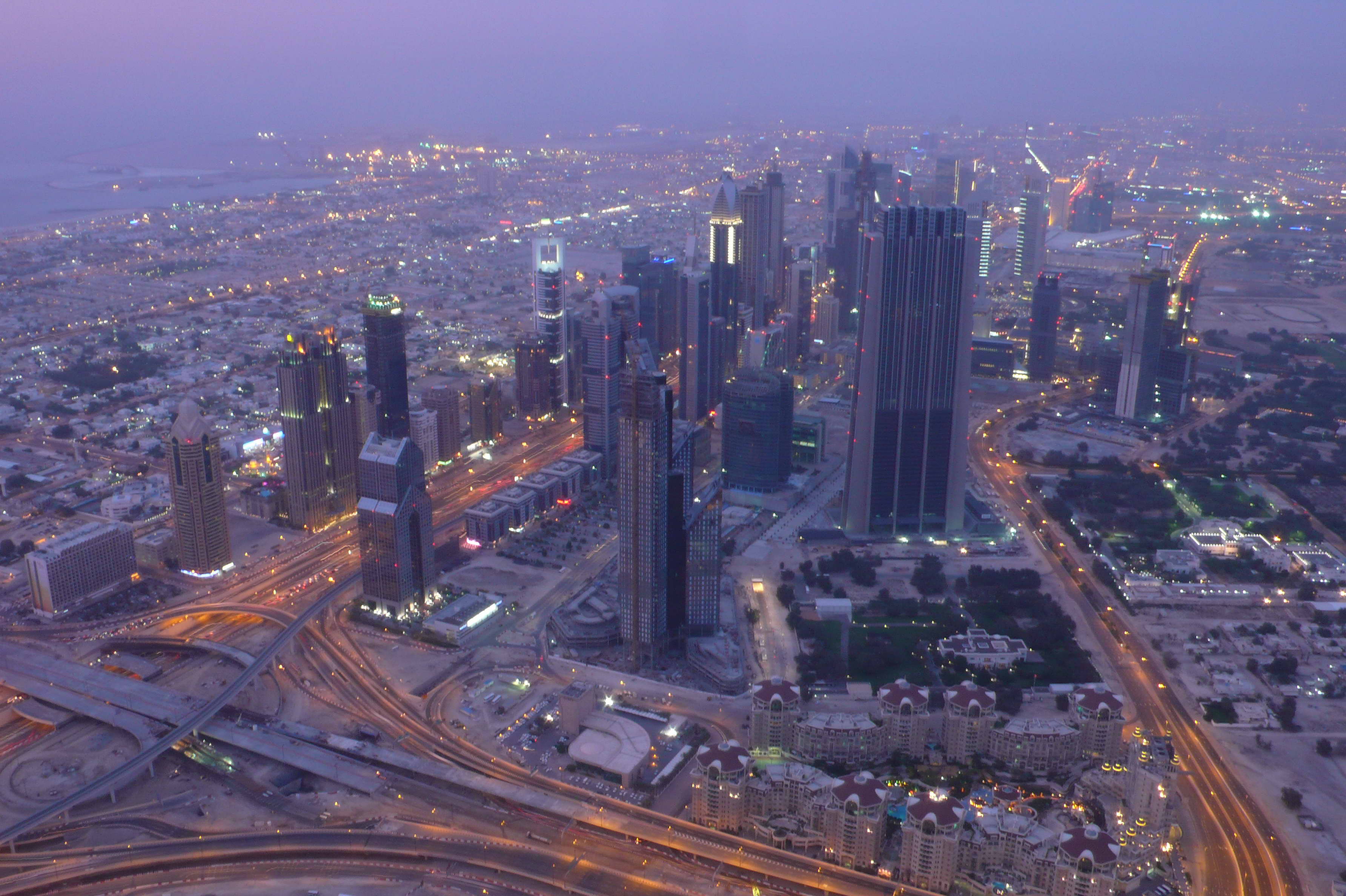
United Arab Emirates, Dubai
FC-01x Future Cities (Self-Paced) - Exercise 1 : "Making the Invisible - Visible"

Uploaded on 2016-08-07 by Joanna Truffaut
1. Upload a photo from your area, or the closest urban area, (the photo must be taken by you) and comment all the information that is visible in this photo. This is a picture of northern part of the city of Dubai. We can see the financial district (DIFC) and Jumeirah on the left side. I took this picture from the top of Burj Khalifa, currently the biggest building on earth. In addition, we can see residential and office towers, the port, traffic interchange, railway for the metro, the main highway crossing the city North-south, called Sheikh Zayed Road, construction areas, vehicles on the road. As the picture was taken at right after sunset, building and street lights were lit up. 2. Identify and present two "invisible information" that can be extracted out of the visible information of this photo. >Building information Data from a building can inform one about how the building is utilized and how efficient it is. For instance, sensors on building material can help gauge the need for maintenance and predict future material/equipment failure. In addition, we can extract information on its energy consumption and opportunity of savings, especially in such arid latitudes like where Dubai is located. >Traffic Traffic data can inform us on traffic flow trends, congestion, peak hours real time info on accidents..., data generated from sensors on parking lots could help drivers locate the nearest available slot around. Traffic data overall can help us better predict traffic and potential reroute vehicles real time to the best alternative road. Data generated by sensors on traffic lights could inform on the level of waiting (car queues) and potential adjust the waiting time. 3. Select one of your choices from the previous question and describe how this invisible information can become knowledge and contribute to the planning of a more livable urban space. According to the government of Dubai, there are an estimated 2.5 million Dubai dwellers. If we take the example of traffic, the Khaleej Times mentioned in a 2016 article that The Road and Transport Authority of Dubai (RTA) estimates there are 540 vehicles registered per 1,000 residents in Dubai; one of the highest in the world. It is fair to say that the commute in Dubai can take a significant part of Dubai and suburb’s people time and therefore affect people’s lives. Therefore, the data generated by traffic sensors is one of the key KPI that can inform about the livability of the city and make the city a better pace to live and work. As described above the information generated by the traffic data can help: - reduce traffic congestion - reduce pollution by reducing congestion and making public transportation more available at times data analysis suggests - improve overall citizen’s mobility through multimodal and smooth transportation which is enhanced via the information generated by the data - reduce accidents - better predict infrastructure maintenance, hence reduce municipality costs - better inform citizens, dramatically reduce peoples’s time spent in transportation And therefore overall make the city a more livable place.