Uploaded on 2017-11-17 by ERIC AMARAL FERREIRA
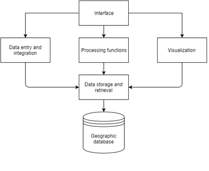
The city app proposal here is like a city’s facebook, the idea is to design a platform that allowed people to interact with government, utility companies and other citizens about the city itself. The platform is designed to operate always using GPS – geographic position system, every action, photo, comments will be recorded and linked the fact or proposal to its geographic information. The components that are implemented by GIS vary according to the need, objective and characteristics of the system, however, they must follow the following structure according to Figure. Suppose that one person is walking in the street and realize the sidewalk is damaged, immediately he gets his mobile take a picture, give a name related to the issue and upload in the app. The picture will be uploaded like “sidewalk damage”, the system will recognize the main characteristics and allocated in the public services section. Anyone, general public or officer, mayor, councilors can see all the posts, compare when it was posted and how long takes to repair the damage. Every citizen would work s a collaborative and responsive to the civil society.