Uploaded on 2017-11-14 by Lidia Grbnv
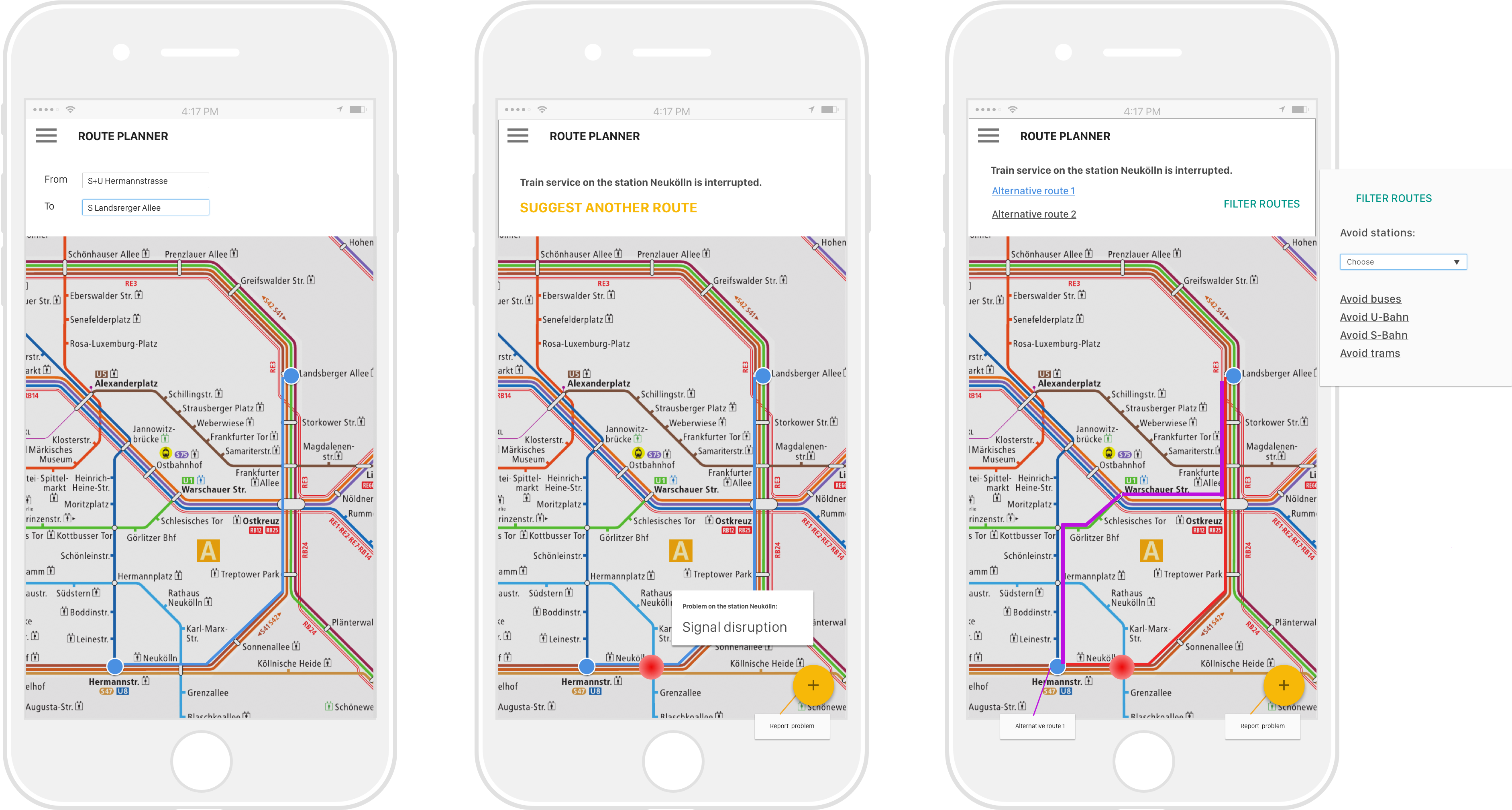
Berlin is a large city and has an extensive network of public transportation including underground and overground trains, buses and trams. Transportation services are very often interrupted. Problem: * information about service interruptions is not available right away * apps don’t show real-time disruptions and alternative ways of reaching destination avoiding stations where the service is interrupted Solution: * Adding a feature of a route planner with a heat map. * Issues with transportation services are reported by passengers (selecting a station and adding a tag from the list to describe the problem) * Problem stations are shown on the map as red dots. A click shows a card with a short problem description. * Choosing another route: planner suggests alternative routes. Routes can be adjusted using filters: avoiding certain stations, types of transportation. Result: * People provide information in real time helping each other to get to their destinations faster. * Lower density of people in problematic areas of the transportation system. * City government gathers data on preferred means of transportation; patterns, frequency, duration and location of issues in the transportation network.