Uploaded on 2017-11-14 by USEFUL STUFF -
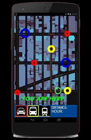
The main idea is the creation of an app. that can read different URBAN FACILITIES (ex. transport), calculate the DISTANCE & the TIME TO REACH, and become INTERACTIVE (if and where possible). The pattern I used here is NY (NEW YORK)--A sample map taken from MAPBOX), but in reality there is no SITE restriction. The location of the user can be specified from GPS, while the transport LOCATION, can be predicted from censors all around the city. For the sake of utility, there has been a maximun distance - whereas for the sake of functionality, every PUBLIC TRANSP. can be ENABLED ONLY MANUAL. The ''WELLBEING MAP'', of THE UNIVERSITY OF EDINBOURG, has been a major influence. Recorded DATA can be used for further GOVERNMENT ACTIONS - (URBANISM) but that does not consist of a main OBJECTIVE.