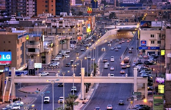
Saudi Arabia, Al Hufūf
FC-01x Future Cities (Self-Paced) - Exercise 1 : "Making the Invisible - Visible"

Uploaded on 2017-06-12 by eslam Helmy Zekry Abd ElGalil
Visual Information: There are many visual information that can be accessed by looking at the picture. The picture shows part of the main transport network in the city. It also shows how well planned it is to have lighting and trees on either side of the road. The sight without harm. In addition to the extensive planning of the road, which helps to move the movement of cars more flexible. Invisible information: With regard to non-visual information, the following is shown to us: 1 - This road constitutes a major input of the city, through parking and monitoring the movement of cars it is possible to easily appreciate the amount of daily movement inside and outside the city. - Other information that can be accessed in an invisible way is the amount of interaction between cars, roads and retail stores located on both sides of the road, in addition to the amount of emissions that emerge from the movement of cars daily from the city to the city. how this invisible information can become knowledge and contribute to the planning of a more livable urban space? It helps greatly to estimate the amount of daily movement of cars on the streets of cities to contribute significantly and effectively in their planning, helping to identify the estimated and prepared cars in the city to plan a network of good streets that accommodate those cars, in addition to planning the locations and locations of supply stations and fuel and the amount of daily quotas Of fuel, in addition to the movement of cars from and to the city usually brings with it a number of people who are doing shopping and buying and thus planning to shops and shops and the sale of quantities of demand for products.