Uploaded on 2016-07-14 by Gabriel Velasquez
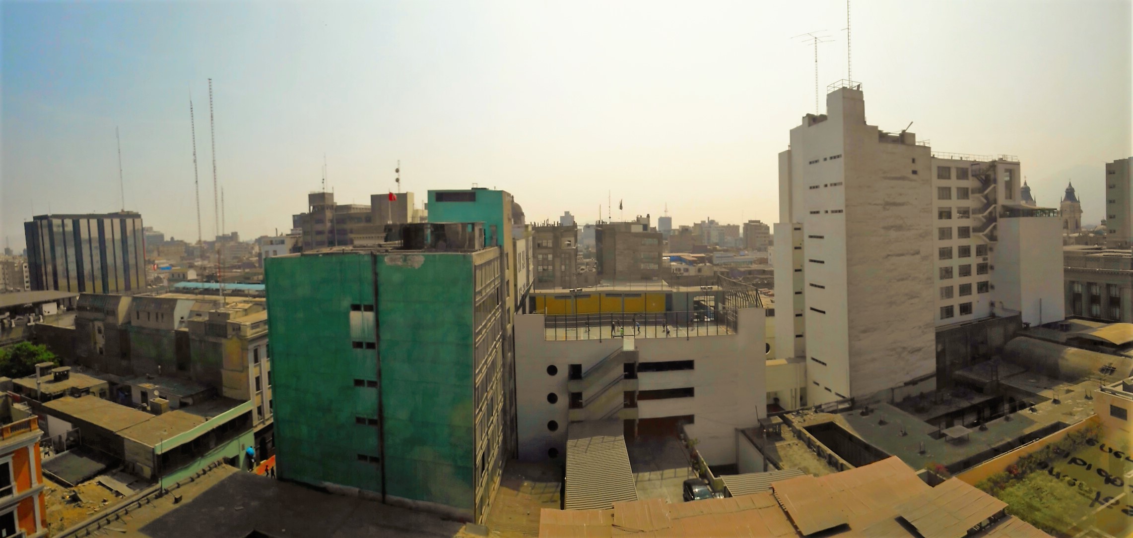
Visible and Invisible Information at the Lima-Perú city centre by Gabriel Velásquez In the photograph shown, we can see a mixture of old and historical buildings (around a few hundred years), like the towers of the Lima Cathedral behind the white building in the upper-right corner; 20th century buildings, as the green one; and modern buildings (from the 2000 to present), like the black with mirrored windows at the left. All of them have different uses, the cathedral has religious purposes; the black, green and the taller white are office buildings; and the white in the middle has a small football pitch on its rooftop. From the picture it may seem that there is not streets or roads, but actually they are there; they are just very narrow. The invisible information that can be extracted is that this area is very crowded on weekdays because offices workers are on duty, and they use the transportation systems of the city in the order of hundreds of thousands times a day. Also, Lima is located on the Pacific Ring of Fire; so earthquakes are frequent, and if the buildings were monitored, it would be possible to determine if their inhabitants are on risk or not. With the information of the transportation systems would be possible to design better ways to get to the Lima city centre, employing different tools like the origin-destiny studies; and then plan the city for the future.