Peru, Miraflores
FC-01x Future Cities (Self-Paced) - Exercise 1 : "Making the Invisible - Visible"

Uploaded on 2017-04-17 by Alberto Herrera Stoll
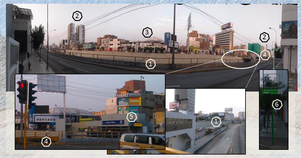
I chose this location because it is an express way at a lower level that extends over several kilometers, whose importance and functionality despite congestion at peak times is undeniable but is perceived as an element that divides the city. A. Visible Information 1. Sense of traffic (south-north only to the center of the city) of the expressway "Via Expresa" (name in Spanish). 2. Construction of buildings dedicated to housing of 12 to 20 floors (ends of the right and left side of the picture) 3. Presence of commercial places and a market (constructions without much quality) 4. Pedestrian and vehicular axis crossing the expressway 5. Public transport station 6. Public signs (street names, traffic sense) B. Invisible Information 1. Number of people using public transport, hours of use and direction of travel 2. This location is the boundary of 2 districts (independent urban areas) each with a type of zoning (type of land use). C. Planning of Public Space Using zoning information from each district and observing how the city is being transformed with the construction of new building mainly housing and office buildings can determine how many more people will use this area and the services that will be required; this could determine changing the type of Land use in some areas.