Italy, Bologna
FC-01x Future Cities (Self-Paced) - Exercise 1 : "Making the Invisible - Visible"

Uploaded on 2017-02-11 by Riccardo Brini
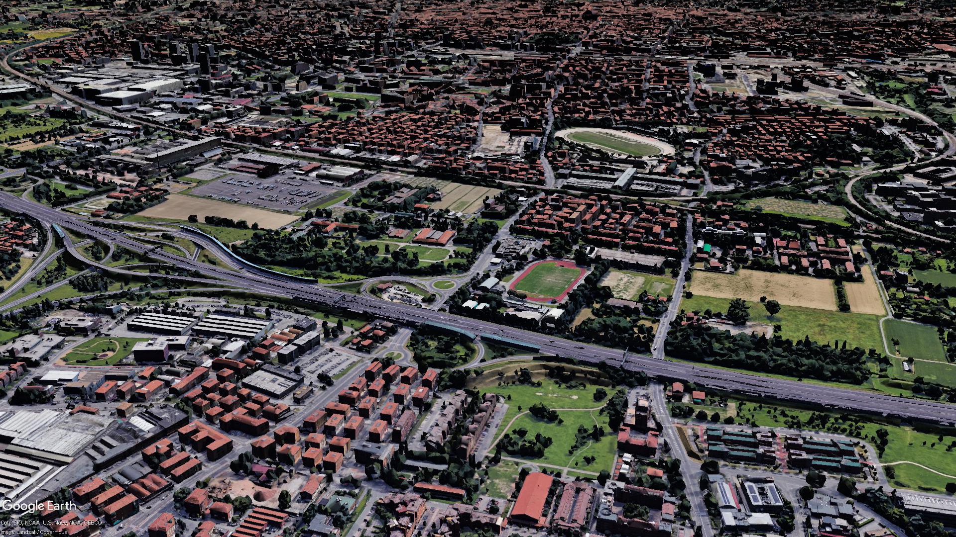
Riccardo Brini, Bologna, Italy: The Ringroad Problem in Bologna I took the photo from Google Earth Pro (freeware software) because I want to emphasize something which hardly I would be able to photograph just with a camera at the person's height. In the foreground is the largest infrastructure of the city and the region: the highway linking all of South and Central Italy to the North (from Rome, Florence, etc. to Milan, Turin, etc.). On the sides of the same run the lanes of the city ring road. The photo does not have cars but normally the traffic is very strong at all hours. In recent years emerged the traffic problem, given that there were periods when it was on average more than 45 minutes to drive for one kilometer. The introduction thus serves to highlight the clear aspects, ie the visible information about this topic: -First the proximity to the city center, in the background, a few kilometers away; -the proximity of houses and service facilities on the street; -The ever-present traffic (not visible in this picture because of the Google Earth 3D model but easily found by searching for "Bologna Tangenziale" of which I do not have photos taken by me, and I will not use pictures of other people); -the non-separation of a structure thus impacting or otherwise no cushioning neither social nor ecological. Studies carried out in Bologna in recent years but also from the experience of any citizen, different data have emerged, two of which are INVISIBLE: -use of the ring road, in theory dedicated to the city, even by users who instead should just pass and overcome the city, given the fact that the Tangenziale (ring road) is free and the highway is a toll; the data thus concerns both the type of user in contrast to the ideal for which the infrastructure should serve both the cause often driving a driver to choose a route rather than another; - Pollution recorded only using special detectors in adjacent areas in particular where there is partial or total lack of green, this is also due to the proximity to the city itself to which many users exploit the same for a few kilometers displacements going to clog traffic and increase the smog. This last problem can become an acquired data and therefore useful if you study the variations of smog emissions at different periods and even different hours based on the activities of people in the area at certain times (the presence of gas clouds in the early afternoon for example next a public park frequented by children will have a different impact to the same situation close to a factory towards the evening when there are no workers). These studies may lead to the study of a new solution further north (refer to the project of the "Passante Nord (North Bypass)" discussed for years by the various municipalities) rather than a work of improvement of surrounding streets to make sure that for short distances people do not use the ringroad and especially the creation of Greenways or green barriers that mitigate the aesthetic and ecological point of view, the effects of this traffic. The precise amount of smog can be useful for identifying the type of plant to be inserted for better mitigation as well as the number of cars that travel short distances and their destinations may be used to resize other ways.