United Kingdom, Edinburgh
FC-01x Future Cities (Self-Paced) - Exercise 1 : "Making the Invisible - Visible"

Uploaded on 2016-06-27 by Samantha Suppiah
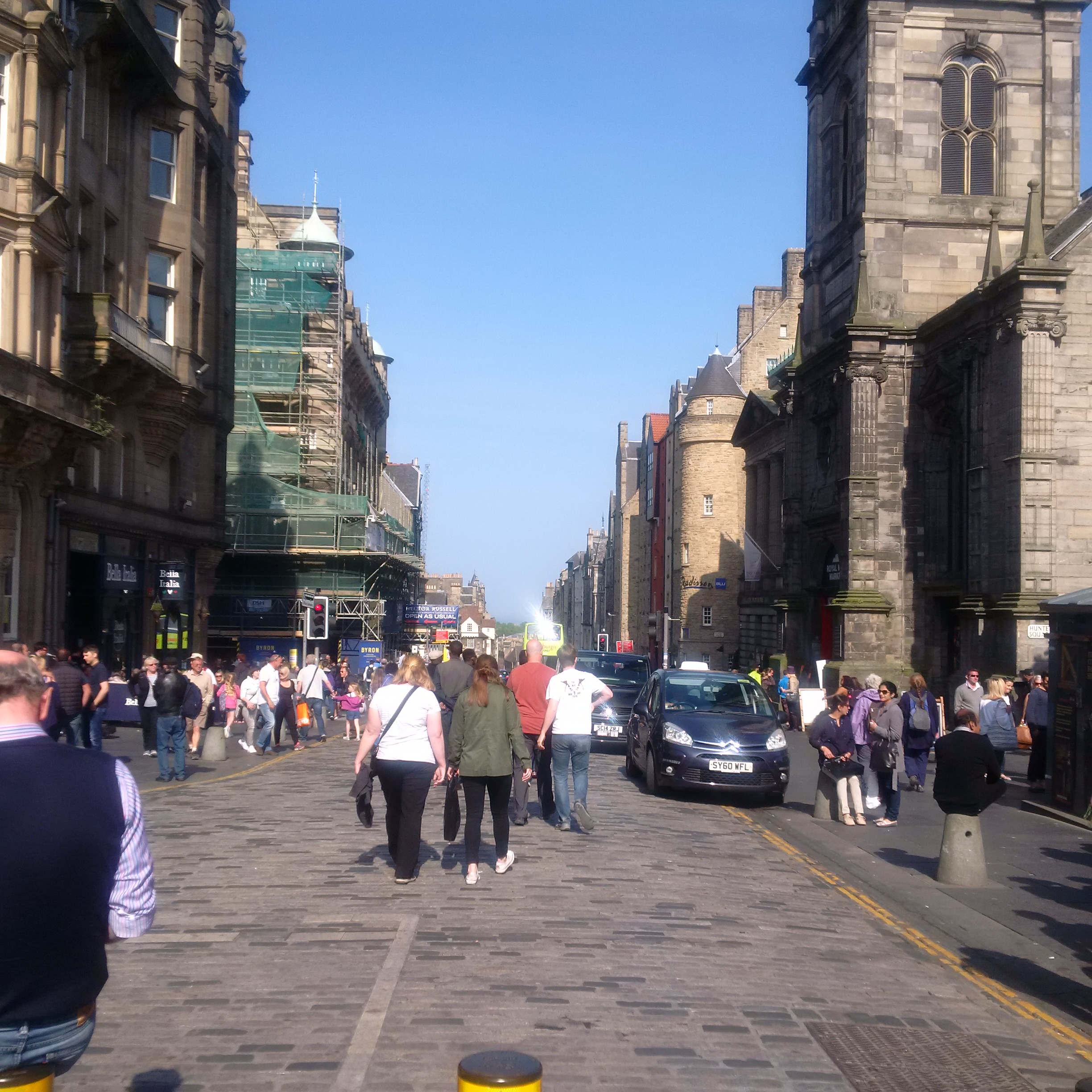
My photograph is taken on the Royal Mile in Edinburgh's Old Town, looking towards the North Bridge junction. High Street on the Royal Mile is the historic heart of the city. The North Bridge is a main transport route connecting the city centre with the south of the city. Visible information in the photograph include: Traffic junction (High Street and North Bridge) -- traffic includes taxis and buses, highly outnumbered by pedestrians Low-rise, historic, traditionally-constructed buildings Narrow street, cobblestoned road lined with bollards, with adjacent paving Partially pedestrianised (timed bollards) High pedestrian traffic (especially due to the warm sunny weather on this June weekend) Narrow pavement is taken up by restaurants' al fresco seating, pop-up signs and scaffolding from building works on the corner Pedestrians using bollards as seats From the above I can extract some invisible information, with a few defining statements. Firstly, as the main activity in the area is tourism, I can deduce that most of the pedestrians in the photograph are tourists. Their seasonal activity indicates that the High Street can be expected to be very crowded with tourists at certain times of year, and relatively empty at others. There is hence an incentive for partially pedestrianising the street in order to increase pedestrian safety and to regulate traffic in the area. However this photograph shows that pedestrian spillage outside of the pedestrianised area still presents a problem, even adjacent to one of the city's main arteries along North Bridge. This is possibly because there is no clear marking or barrier between the pedestrianised and non-pedestrianised parts of the street apart from two active bollards and a small sign (both of which could be missed in a crowd such as this). Secondly, pavement area has been taken up by al fresco seating, scaffolding and pop-up signs. These have been previously approved by the City's Planning Office, and may be reconsidered. These street elements serve to take up pavement space which would otherwise have been used by pedestrians, resulting in significantly compromised safety and slowing down pedestrian and road traffic. This demonstrates a brief analysis of a traffic pinchpoint that could be very useful in improving the movement of people and visibility of services on the High Street and adjacent roads.