Honduras, Tegucigalpa
FC-01x Future Cities (Self-Paced) - Exercise 1 : "Making the Invisible - Visible"

Uploaded on 2016-11-23 by Pedro Pablo Ramirez Carias
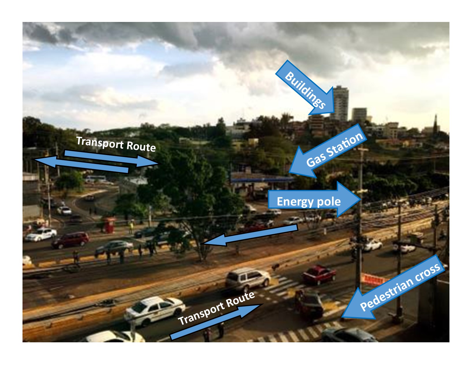
Location: https://www.google.hn/maps/@14.0855538,-87.1864137,18.78z Visible information: 1. Private cars, taxies (whites) and people using the available infrastructure for their journeys. 2. Energy lines supplying electricity 3. Pedestrian crossing 4. Trees, vegetation 5. Buildings, houses 6. Gas station Invisible information 1. This is a high traffic area for vehicles and people. 2. Two routes encounter themselves coming from dense residential, commercial and education areas. 3. A shopping center is about half kilometer from this zone, perhaps the second biggest in Honduras, commerce and financial services are available with concentrated job places. 4. Cars going to the left of the photo have their journey to the National and public university and to the peripheral ring road that connects to the south area of Tegucigalpa. 5. Cars going to the left are taking the route to center area of the city where offices and popular markets are. 6. People using buses and taxis shift from one route to the other, others take the route to nearby job places around the area of this photo. Knowledge may contribute to the planning of a more livable urban space: 1. Pedestrian cross is using by some people but many take different paths due to high traffic on streets. 2. Cars in the queue going to the left are waiting to enter into the short path to the shopping center area. A return facility is needing for cars with journey the contrary (street going to the right), some cars do complicated maneuvers at the end of short tunnel that cut the flow of cars. 3. Energy lines are mostly connected by superficial poles, during tropical storm season is a common event be out of energy due to trees falling the lines and by thunderstorms. Public transportation is not attractive for middle and high socio economic sectors, this aspect triggers use of cars over the street capacity.