Uploaded on 2016-11-17 by Hibon
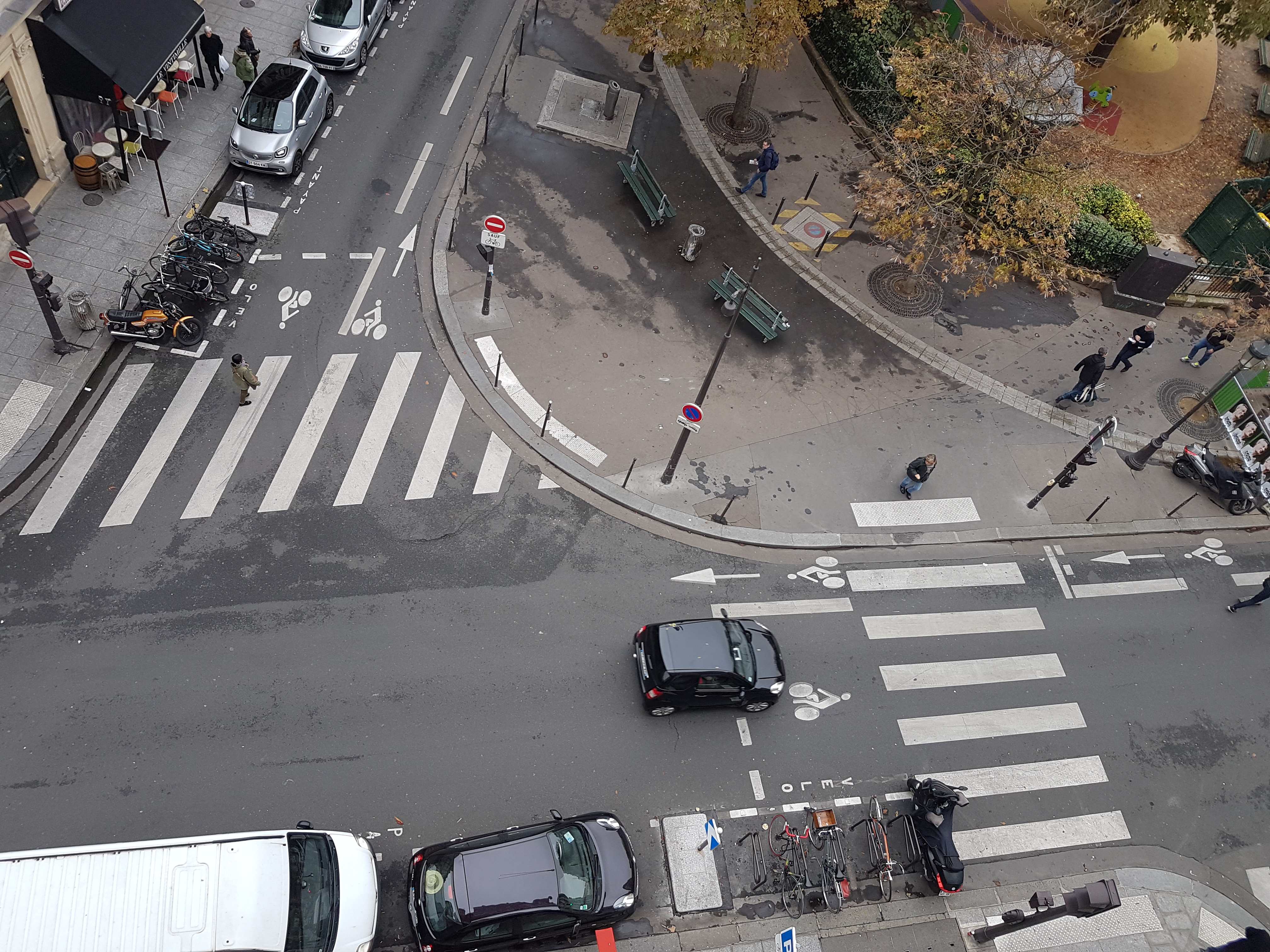
This is an aerial view of a street crossing close to my home in Paris, 9th arrondissement. Among all the visible information present here, I can list : - delimited cycles' parking (2 spaces) - cycles' specific green/red lights going counter traffic-wise - Cycles area to park ahead of cars at red lights - square garden space with children playground - 2 benches close to the middle square - Street litter boxes - Traffic signalisation signs - Street crossing' red/green lights - Underground glass collector opening freeing space for people to walk around and limiting crash sounds as bottles drop/shatter below ground - Trees incorporated in street pavement within 1m diameter iron carved grids - Cars, cycles and motorcycles parked or not - Paying parking spaces (Public) - Crossing signage on pavement for blind people (and a small beige box fixed on the red light post that starts a loud bip when blind people tap on it) - small posts to prevent cars parking on square area - street markings to signal crossing areas, cycles' activities and nature of parking spaces - curved mid-pavement ring to facilitate caption & flow of rain/cleanage water Invisible information that can be derived from this picture include : - Cycling traffic: There was a fatal accident last year when a lorry overrun a cyclist at the red lights. Since then the city has deployed additional parking spaces for cycles, traffic markings and authorised cyclers to ride counter-traffic so as to facilitate traffic flows. Ability to track number of bicycles that circulate on a daily basis and use of these parking spaces would help get a better sense of impact of such initiatives on security and transportation flows and whether these could be deployed further. - Green space : this is an area of Paris with very little greenage and narrow streets. monitoring the usage of these benches and human traffic close to that space can help better design facilities to ensure safety of children and preservation of nature in a cost-efficient way.