Uploaded on 2015-06-09 by WBJmom
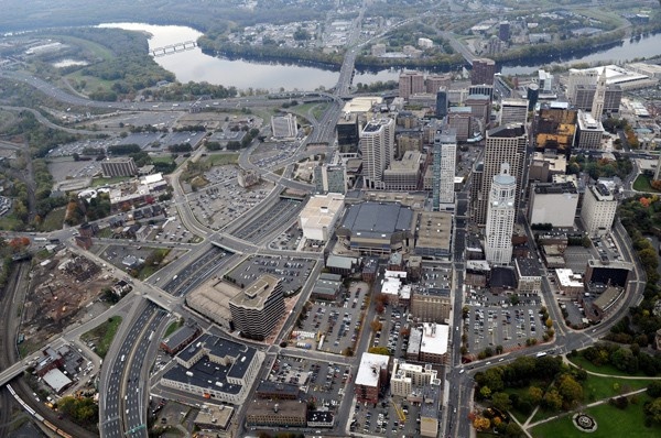
[1]: https://edxuploads.s3.amazonaws.com/14338606157673228.jpg This is an aerial photo of Hartford Connecticut by Stephen Dunn of the Hartford Courant (http://web.colby.edu/ckasprak/category/aerial-views-of-sprawl/). The impact of transportation is very apparent. It highlights the intersection of two highways I-84 running east west (up and down in the photo) and I-91 running north-south (left to right along the river in this photo) and the abundance of parking provided for the city (noted at the time of the photo to have more parking lots than buildings). I-91 has already been redesigned as it originally completely cut the city off from the river. We now have a city park and performance venue along the river where I-91 was lowered. Hartford is currently moving forward with updating the I-84 corridor. From their website www.i84hartford.com - "The I-84 Hartford Project corridor is less than two miles long; however, it comprises approximately 4.3 miles of mainline and ramp bridges with a total elevated deck area of more than 1.1 million sq. ft., or about 25 acres. These structures were originally designed in the 1960s for a 50-year service life. Now that they are reaching the end of their intended life span, costly and frequent repairs are routinely needed to control their continued deterioration." Transportation in Hartford clutters the city space and artificially defines its boundaries.