Uploaded on 2014-11-20 by k_negm
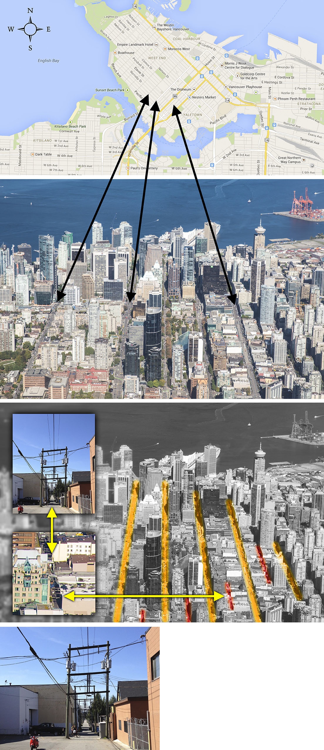
The downtown core, with English Bay on one side and Burrard Inlet on the other, is a peninsula that lies west-northwest (or east-southeast.) Due to its geography, Vancouver lives at its edges, and so it orients itself by its edges as well. The mountains are north, always visible through the towers that adorn the downtown core. And with the ocean surrounding downtown on almost all four sides, it’s easy to figure out orientation based on which beach is there. What is interesting, is that there’s a secondary grid of wooden utility poles running throughout Vancouver’s back alleys. In most major cities, much of the transmission infrastructure – power lines, telephone lines, and fibre optic cables — has been buried underground. Vancouver is said to be one of the few cities of its size where much of its cabling is still visible overhead, interrupting the nice views and apparently posing earthquake risks. ![Map from Google Maps. Aerial & Ground photos by me][1] Key: - Orange - Main Streets - Red - Back Alleys Note: Picture of wooden utility pole is from a different location in the city and only used as an example. [1]: https://edxuploads.s3.amazonaws.com/14165264394047459.jpg