Uploaded on 2014-12-08 by agmenen
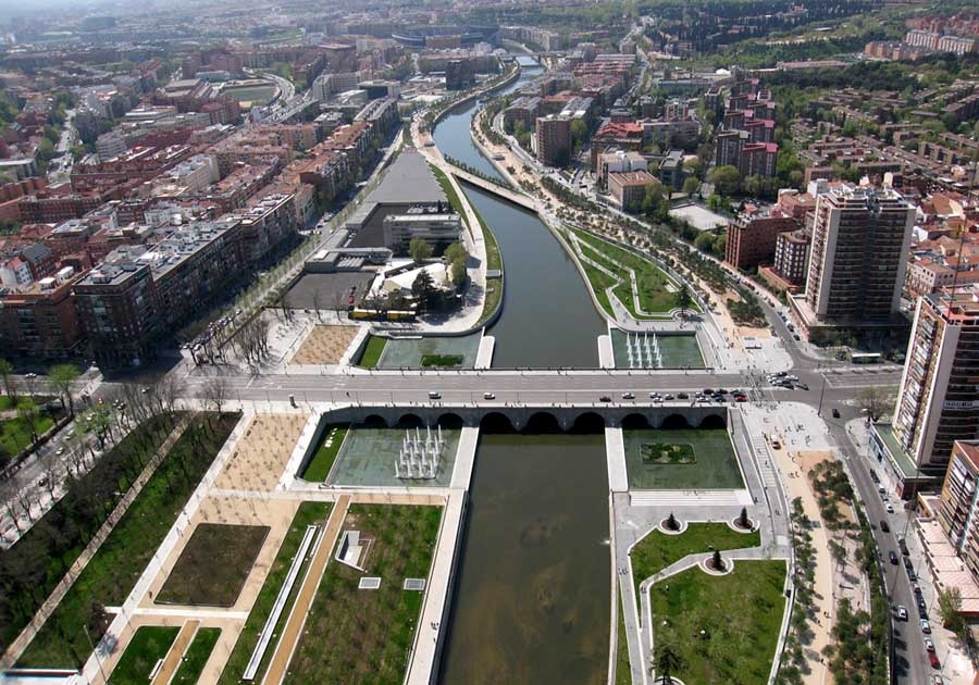
area of the river, a work that made possible the elimination of surface traffic and theconsequent release of over fifty acres of land formerly occupied by driveways. This surface other joined almost a hundred hectares corresponding to different soilsunderutilized adjacent to the highway. After the construction of the tunnels surfaced an empty wound formed by a string of unoccupied spaces, treasured the latent power to become nexus of an environmental corridor almost three hectares within the municipality, which stretches from El Pardo to Getafe and linking all important green areas of the city such as Casa de Campo, the Arganzuela Park or South Park Manzanares. Therefore, the benefits obtained by burying the old highway obviously not have been reduced to improve certain aspects of urban mobility, even at the local rehabilitation of neighborhoods, but can be purchased in the near future, a dimension large-scale must necessarily affect the relationship between the city and the territory, understood in its broader scope. The enormous significance for the city of liberated spaces following the burial of the M-30, led to the Madrid City Council to convene an International Competition for conceiving and designing the new open spaces in the vicinity of the river. The competition was won by an association of architectural firms led by Ginés Garrido Madrid and Burgos & Garrido consisting Architects, Porras & La Casta and Rubio & Álvarez-Sala. This team, in collaboration with the Dutch office West8, the solution for the construction of a city park over three hundred acres, which occupies released by the burial of the highway surface.![enter image description here][1] [1]: https://edxuploads.s3.amazonaws.com/14180775069895217.jpg