Movability in Melbourne, Australia
FC-02x Livable Future Cities (1st Run) - Compulsory Exercise 5

Uploaded on 2015-12-07 by PhillHinch
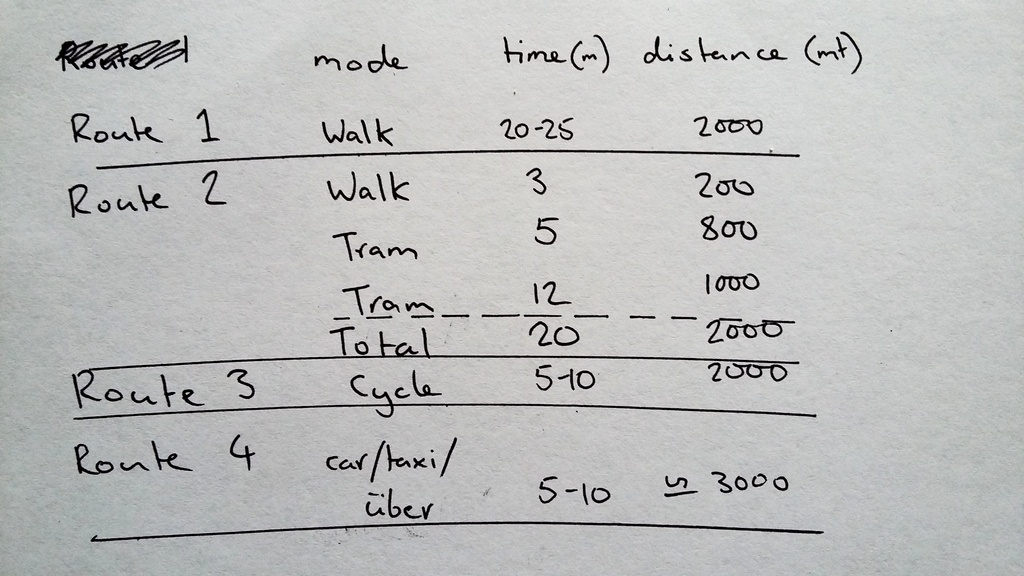
My main workplace is approximately 2 kilometres from my house. I work there four shifts a week, these shifts start in the afternoon, and finish anywhere between midnight and 5am. I would say that I ride my bicycle to work at least ninety percent of the time. It is the fastest way there (equal to driving), feels moderately safe (although a recent survey found one of the streets I ride down has the second highest rate of accidents for cyclists in Melbourne), and I enjoy the bit of exercise and mental stimulation of cycling. I also like to take a longer way home (up to 10km) after work as a way of winding down before sleep. On rare occasions I will also walk to work. I enjoy walking and on the way to work it is safe and comfortable, and there are many amenities. Along the way, for example I can stop at a choice of many shops and restaurants and buy a snack or meal. Apart from the extra time, the main reason I don't walk more often is that the route that feels safe during the day does not late at night for the return trip. The 25 minutes feel much longer when it doesn't feel particularly safe and there are no longer friendly people and open shops around. Catching a tram is not really a good way to travel such a short distance. The route also requires a change of tram and a possible wait with it. Tickets for the tram cost around $5 for no perceived benefit over walking and they do not run late at night. The last option is to commute by car. I do not own a car as the costs for parking in my area are very high, along with the costs of the car itself, insurance and registration. This leaves the option of taxis or uber. These are both quick and plentiful at the hours of my commute, but a return fare would be at least $25, which seems like a waste of money in my circumstances. Map of the different options for travelling to work![enter image description here][2] [1]: http://i1039.photobucket.com/albums/a479/phillhinch/20151207_145940_zpsxgttzkri.jpg [2]: http://i1039.photobucket.com/albums/a479/phillhinch/20151207_145920_zps9p6727vl.jpg Table showing route times and distances