Digitally Augmented Master Plan Design Process
FC-02x Livable Future Cities (1st Run) - Compulsory Exercise 6

Uploaded on 2015-11-25 by Kminek
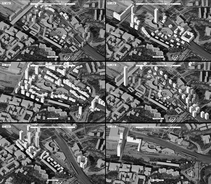
---------- ---------- Master Plans in Poland are created nationwide within the same collaborative and temporal framework regulated by the government. Even though public discussion is ensured, rarely does it produce satisfactory results. One of the reasons might be the fact that it happens at the very end of the long design process where only minor enhancements are possible. Citizen Design Science could also be used in the preliminary phase and further extended throughout the very master plan creation procedure. Such a project would generate a plan in response to the needs of the citizens – both articulated in discussions and collected (and potentially not even recognized by the citizens themselves) thorugh digital data aggregation. ![enter image description here][1] **Image Above: Master Plan 3D visualization.** *Source: Own work.* ---------- We live in the advent of digital technology. Mobile phones and wearable devices make participation possible with virtually no active effort needed. Not only the responders do not need to fill surveys that would consume their time. GPS, gyroscopes and accelerometers make the data collected more accurate than ever and exclude the surveying human error factor. Data generated through crowd sourcing can make the invisible visible in ways before not imaginable and get the process beyond abstract figures, indicators or indices. A mobile phone / watch app could be promoted in the city so the citizens can individually collect and share their daily commute paths, leisure places and other relevant information; all done seamlessly by an app working in the background. ![enter image description here][2] **Image Above: Runners GPS data collected in NYC.** *Source: Yes Yes No Design Agency for Nike.* ---------- The support of citizens in the design process of the future public amenities is nothing but priceless. Individual observation, human cognition, experience and local knowledge are of high value in urban design. Participatory and inclusive processes have yet another handy tool to use nowadays. Online forums and collaboration services can be used as an easily accessible platform for sharing ideas and constructing comprehensive, multi-faceted design proposals: a series of iterative estimations or simply best guesses that can be subsequently thoroughly scrutinized and further improved. Data could be collected using the very same app (with voting system perhaps?) while a team of professionals would be responsible for managing the process. ![enter image description here][3] **Image Above: Results of a participatory urban planning workshop** *Source: Dodory and Petri Kangassalo, http://abe.aalto.fi/en/researchprojects/plan-p/* ---------- [1]: https://edxuploads.s3.amazonaws.com/14484573987773233.png [2]: https://edxuploads.s3.amazonaws.com/14484574217061775.jpg [3]: https://edxuploads.s3.amazonaws.com/14484575202429431.jpg