Uploaded on 2020-07-29 by Tam Teng Ken
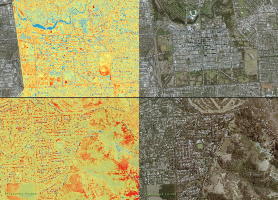
Questions 2 -Location 1: Adelaide, Australia Adelaide city has a relatively rich vegetation with the Adelaide Parklands circling the Central Business District which provides residents good access to green spaces. Research identified a 2.4 C temperature variation in Adelaide during the late afternoon. The heat mapping indicates most hot spots are located on the open spaces within the Adelaide parklands and on the streets; most likely contributed by modified land surfaces into impervious urban surfaces such as bitumen streets,concrete pavements and gravel surfaces. The city is mainly medium density buildings which helps with heat removal. -Location 2: Rural Adelaide (Belair), Australia The rural region is surrounded by vegetation rich hills. The heat map indicates that the heat focus is distributed mainly on the hill faces which have bald vegetation spot; these spots are mainly open spaces or roads. Small hot spots are located on suburban housing which may increase energy usage due to cooling especially in the summer. Question 3 The main measure I would suggest is to implement government supported initiatives to promote green roofs and walls in current or new developments. Question 4 Adelaide's UHI policy focuses on increasing street canopy coverage within laneway revitalisation programs.