Spain, Barcelona
FC-01x Future Cities (Self-Paced) - Exercise 1 : "Making the Invisible - Visible"
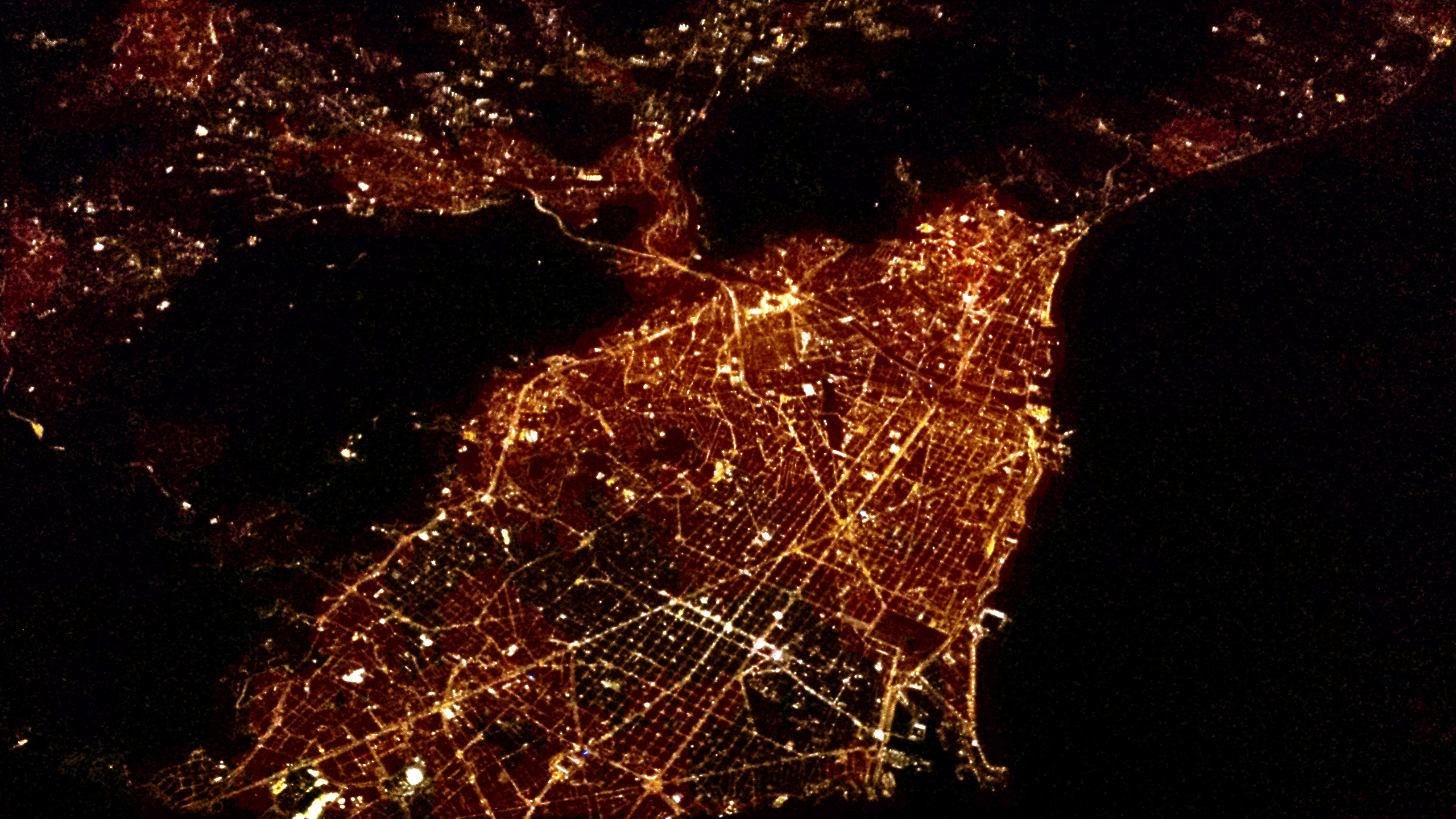
Uploaded on 2019-08-24 by Ruben Gayarre
Photo taken by me in a plane from Rome to Madrid at night. 25th February 2018. The original photo is quite dark so brightness and contrast have been corrected. VISIBLE INFORMATION Urban grid of Barcelona. Square grid and avenues converging at Plaza Glorias. Highways and orbital. The bright spot top centre is a massive roundabout. Land and sea. The bright and active waterfront. The port. Neighbourhoods. In darker Gracia and Gothic Center. Brighter spots left bottom Les Corts. Geographic features: river Besos and mountains. INVISIBLE INFORMATION Pattern of growth of the city: By comparing areal night pictures of Barcelona during several years we can ascertain the expansion towards the suburbs, the decline of certain neighbourhoods or the changes in activities (residential, commercial, recreational…). With the correct images even wealth and income can be analysed. A decrease in lights may mean a decline or migration of population, a decline in the income of residents or a change in the zoning. This information can be used by the local administrations to tackle urban decline or impoverished districts through active and precise policies. Light pollution: Birds, mammals and plants biorhythms are altered when artificial illumination transforms the night into day.