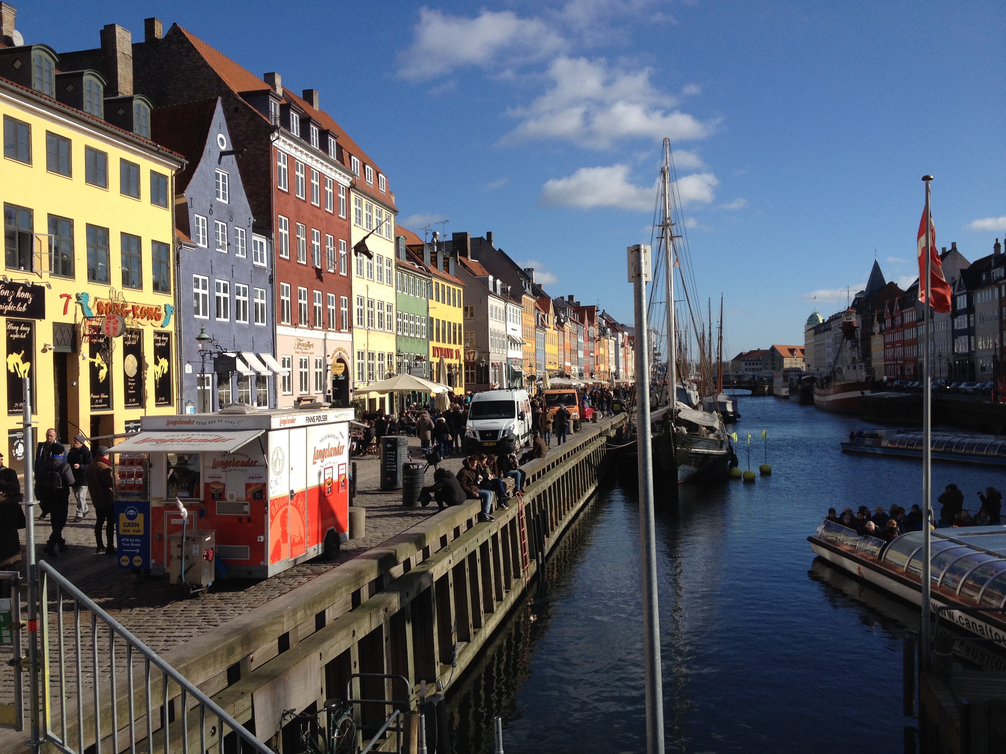
Denmark, Copenhagen
FC-01x Future Cities (Self-Paced) - Exercise 1 : "Making the Invisible - Visible"

Uploaded on 2017-09-23 by Axel Eduardo Solares Ambrosio
Copenhagen, Denmark. VISIBLE INFORMATION. This photo was taken in Copenhagen by the end of the winter season. Though there was a lot of sun, there environment was still cold. The visible information in this image can be identified pretty easy. First of all this seems to be a shared space street with more tendencies to be used by pedestrians. The second factor that makes this street attractive is that is located next to the river and hence the land use there tends to be mixed (retail and housing mostly) attracting a big number of people. The third factor is that the buildings are not so high, hence this could be a street in the city center. A fourth characteristic is that this street receives a lot of sun the entire morning and in a cold country like Denmark, this is an important factor for people. INVISIBLE INFORMATION. The first invisible information that can be seen in the photo is how the spatial configuration and the different layers (street, river/water, buildings) that create the whole space, work as key factors to attract people and to influence or even dictate how they use the space. The second invisible information that can be depicted from the photo is the high pedestrian traffic in the zone. Due to relevant elements in the space, pedestrians make use of this space and all the activities it offers. By analyzing all the information together and making use of tools like space syntax, it might be possible to understand movement patterns and behaviors. The result can be used later to create similar spaces in different cities all over the world, of course it is extremely important to take into account some others factors like culture and context if these spaces are to succeed like the one shown in this photo. Promoting pedestrian friendly spaces and TOD cities, is fundamental to the development of cities and improve the life quality of citizens.