Saudi Arabia, Riyadh
FC-01x Future Cities (Self-Paced) - Exercise 1 : "Making the Invisible - Visible"
Uploaded on 2017-01-16 by Mohammed Aljuraiban
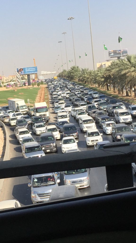
Upload a photo from your area, or the closest urban area, (the photo must be taken by you) and comment all the information that is visible in this photo: This is a photo of the eastern ring road in Riyadh during normal daily rush hour. Identify and present two "invisible information" that can be extracted out of the visible information of this photo: The two pieces of invisible info that I read in this and will provide are. First that a lot of these cars travel to around the same areas in the center of the city, and this crazy traffic is caused because of urban sprawl. the second piece of info is that most of these cars have one person in them. Select one of your choices from the previous question and describe how this invisible information can become knowledge and contribute to the planning of a more livable urban space: The solution to one of the main planning mistakes in my city is to centralize the city. No one lives around the center, how ever most goverment buildings and ministries and gov jobs are around the center, the city keeps sprawling to the outside more and more, and more transportation issues are rising. I think the city should be more centralized for living, two there should be a great and very organized public transportation system (which they are working on.) Three if anything it should be the opposite, gov offices should be on the edges, in order to spread the people out instead of having them all travel and pile up in one place.