HEAT ISLAND EFFECT in Sofia, Bulgaria
FC-02x Livable Future Cities (1st Run) - Compulsory Exercise 2

Uploaded on 2015-11-10 by LillyMiteva
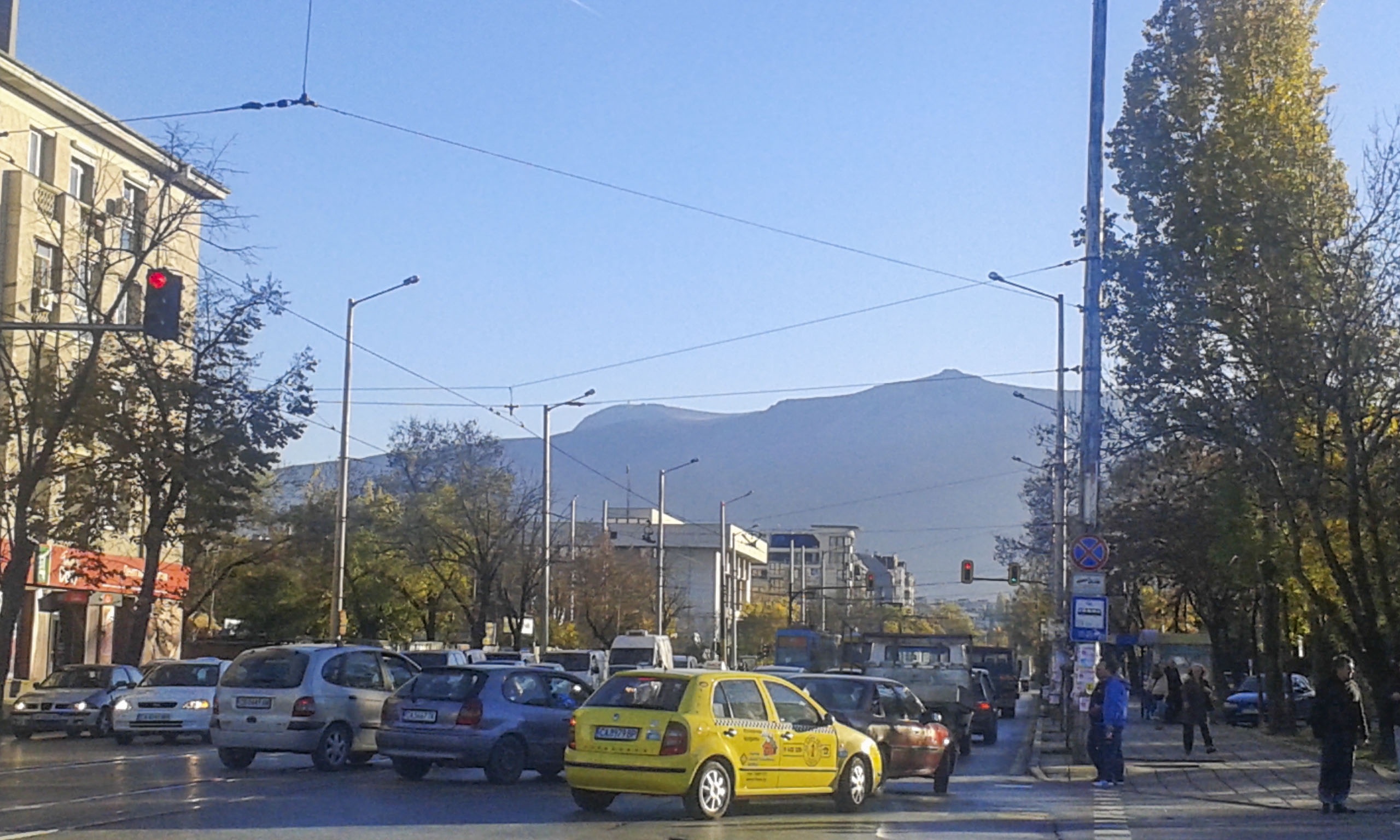
UHI effects in Sofia Firstly, I think it is important to introduce the city geographical situation on the map of Bulgaria. It is 42.5° north, 23.2° east, 564 m above the sea level. Its climate is moderate but there is also an air inversion because the city is in a hollow so it is surrounded by higher terrain of a mountain. This air inversion sometimes refers to higher temperatures in the surrounding higher terrain compared to the temperatures in the lower terrain in the depression. The results of the measurements of the Thermal Structure of Large Central European cities (Bucuresti, Budapest, Warszawa, Vienna, Milan, Munich, Sofia, Beograd, Zagreb) in 1999-2002 show a monthly mean urban heat island (UHI) with intensities between 1 °and 6 ° C and the most intense UHI occurs in day time during summer time. The spatial structure of UHI in winter and summer in day-time (left panel) and night-time (right panel), respectively are illustrated bellow. The seasonal mean difference between the temperature of each pixel and the rural mean temperature is presented on the maps. The warmest part of the city is the downtown area (administrative and commercial center). In general, these downtown warm spots are 4-6°C and 2-3°C colder on winter days and nights, respectively, than in summer. The difference between the warmest and the coldest surface temperature exceeds 15°C in summer days where mountains are near the city - Sofia. UHI in Sofia is very special, since Mountain Vitosha (2224 m) is located very close to the Bulgarian capital (mean elevation of Sofia is 550 m), that results in large temperature gradient within the selected rural area around the city, especially in summer. (Pixel representations of these selected urban agglomerations (including their rural environment) have been determined from a satellite image tile containing 1200×1200 pixels using sinusoid projection. Based on the spatial extension of the selected Central European cities, each urban agglomeration is represented by 50×50 pixels from the entire satellite image. The representative areas have been divided into urban and rural pixels in case of each city.) The urban heat Island in Sofia has been noticed and monitor in the past three decades. The annual solar light has been decreased in the past decades as well due to more air pollution. Fogs and smog are something usual in the city of Sofia during winter and less in autumn, and spring. 2. Compare the two images. The first image is taken in one of the central areas of the city. It shows the boulevards, the buildings and their façade materials, the vehicles (cars) - all those reasons to the UHI effects. There are some tall buildings you can see far distance. They are office buildings. Although these factors there are also trees and trams for the need of public transport that are not releasing C02 in the air. The second image is also taken in the city but it shows the mountain that bounds the city. This is the complete nature without the touch of human. The air is fresh and not polluted there. There are only one or two roads that are passing through it so they can’t make much change to it. The climate is colder but it is defined by the forests and the higher terrain. 3. Which are the measures you would propose? I would encourage developing more green areas and greenery in the city itself. There should be more trees on the streets especially on the huge boulevards. I would suggest that people should use the public transport in this case the metro, the tram, the trolley that are empowered by electricity and do not pollute the air with C02 . The effect of the urban heat island should be considered when designing new buildings and reconstructing old ones. It could be measured for the new project and if it is assisting the UHI the project shouldn’t be approved. There should be less asphalt, concrete and etc. Other materials should be tested for building industry that are not reflecting or keeping the solar energy. The urban planning should consider the different schemes that are either capturing or releasing the heat and winds so that the UHI effects could be eliminated. 4. Is UHI effect concerning policy making in your area? The development of the metro (the subway) and creating new spurs of it is one initiative for less polluted city. It is sponsored by European Union as an environmental friendly transport project. The results are that more and more people are using it as a transport instead of driving a car. There are green organizations that are saving plants, and trees but they are not part of the community policy I would say. There are some parts of the city center that have pavements on the streets instead of asphalt. And there are debates about changing it to asphalt but I’m glad there are still a lot of people thinking about the advantages of the pavements. They are made from stones, the rain water goes through the gaps between them and the ground is not sealed the same way as when there is asphalt. I think it helps to prevent the UHI effects. ![The spatial structure of UHI in winter and summer in day-time (left panel) and night-time (right panel) in Sofia and the region around it][1] ![The city of Sofia. One of the central areas of it.][2] ![The background of this image shows the mountain Vitosha which is very close to Sofia][3] [1]: https://edxuploads.s3.amazonaws.com/14471601512164283.jpg [2]: https://edxuploads.s3.amazonaws.com/14471603397953219.jpg [3]: https://edxuploads.s3.amazonaws.com/14471603938826684.jpg