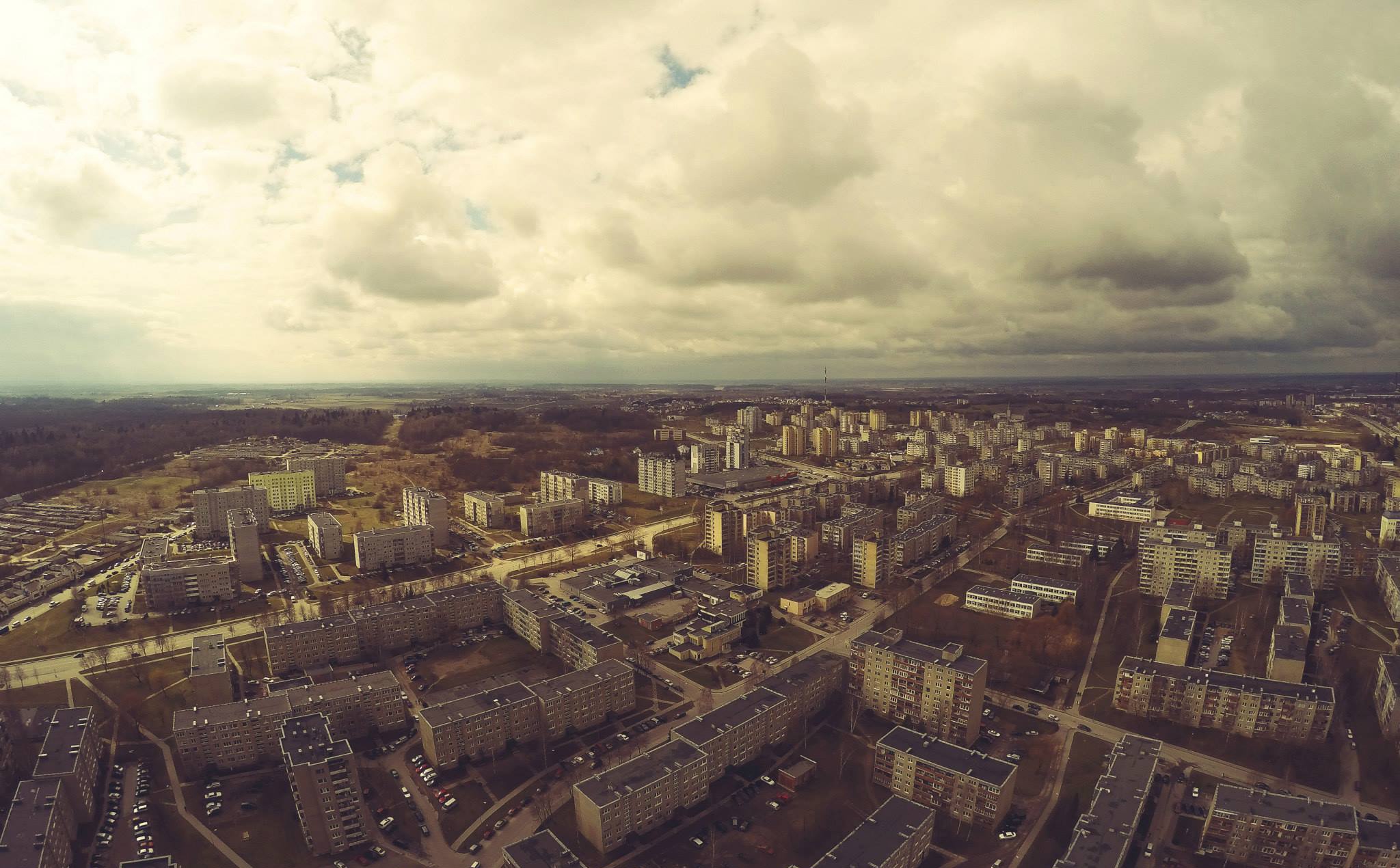
Alytus, Lithuania. Making the invisible - visible
FC-01x Future Cities (1st Run) - Exercise 1 : "Making the Invisible - Visible"

Uploaded on 2015-04-29 by RemigijusK
Alytus is situated on southern part of Lithuania. Picture was taken flying above one of 7 town's block. **Visible information in this picture is**: There are 100 blocks of flats approximately. 2 schools, 4 kindergarten buildings, 7 trading areas, TV tower are visible. Every block of flats has individual parking space which is heavily congested. Flatlands are visible behind the western boundary of a town. Picture shows network of roads and sidewalks connecting different parts of Vidzgiris. **Two “invisible information” that can be extracted out of this picture**: One of many “*invisible information*” ideas which are hidden, but can be extracted out of picture would be **the energy consumption**. At the left side of the image there is one renovated block of flats. Moreover, there is more than one building at the moment which was renovated recently. There is a field of “*invisible information*” opportunity where efficiency of old and refurbished buildings could be compared. Another potential opportunity of implementing the “*invisible information*” idea would be - monitored parking spaces of inhabitants for each block of flats. It could help to improve situation where spaces are overcrowded and regulated chaotically. ***“Invisible information”* of energy consumption can become knowledge and contribute to the planning of a more livable urban space**. Data and then information with regards to energy consumption of renovated houses could be gathered and then compared to those buildings which are still waiting for update. It could inspire more rapid housing renovation and probably usage of renewable energy as well (Flatlands suitable for solar and wind energy). This type of “*Invisible information*” could contribute to efficient monitoring of household’s energy consumption, their needs and planning the future investments into town’s development. It would draw clear image of energy consumption for architects, urban and civil engineers, scientists and inhabitants, who could use data converted into information for their own and whole town life’s efficiency. [1]: https://edxuploads.s3.amazonaws.com/1430303278527245.jpg