Invisible --> Visible: Trinidad, POS
FC-01x Future Cities (1st Run) - Exercise 1 : "Making the Invisible - Visible"

Uploaded on 2015-04-21 by ShivDookhoo
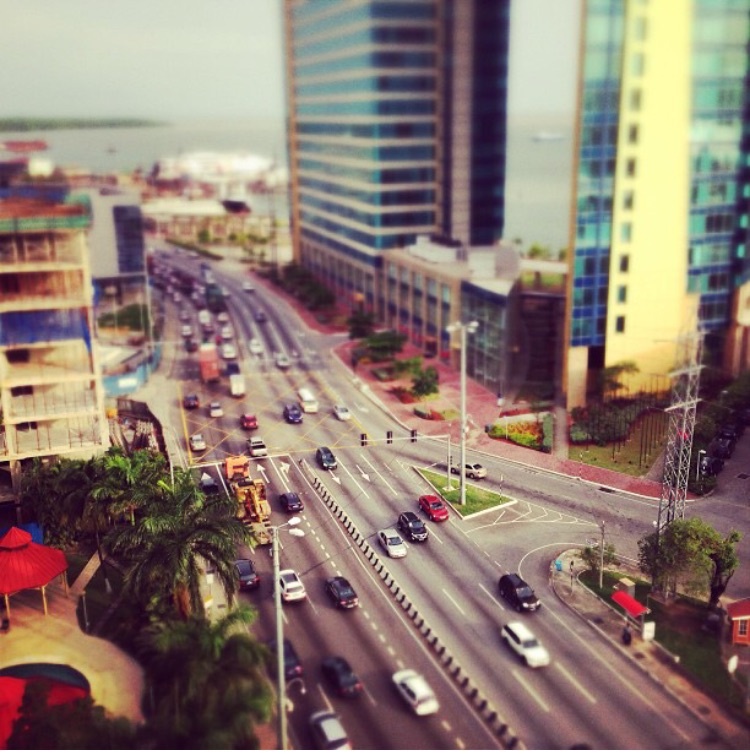
[1]: https://edxuploads.s3.amazonaws.com/14296411863884194.jpg 1) This photo shows Wrightson Road in Port of Spain, the capital of Trinidad and Tobago. We can see vehicles entering (right of the barricade) and exiting (left of the barricade) the capital. There is a building under construction on the left that will most likely be used as an office building. To the right we have the Port of Spain International Waterfront Centre which are two 26 storey office towers. In the background, there is the terminal for the ferry service that operates between Port of Spain and San Fernando (another major city). 2) One of the invisible that can deciphered from this photo is the lack of public transportation. There are no signs of buses, trains, trams etc. There are no bike lanes. The only form of public transportation in and around the city is via hired cars. Another invisible is beneath the roadway. There are water lines, sewer and drainage, some communication lines and possibly gas lines. Electricity lines are run above ground on poles. 3) On the point of lack of public transportation in and around the city, this is as a result of the layout of the city, the affordability of private vehicles, the subsidy on petroleum and the culture of unreliable public transportation elsewhere in the country. In order to further understand this problem, the symptoms need to be analyzed to learn how they affect public, the city, the economy and the environment. The results from such a study can be used to plan a public transportation infrastructure that is suitable and reliable in the city which should also be sustainable in operation.