3.6 Exercise 1 - WRT
FC-01x Future Cities (1st Run) - Exercise 1 : "Making the Invisible - Visible"

Uploaded on 2015-04-23 by chrisjongkind
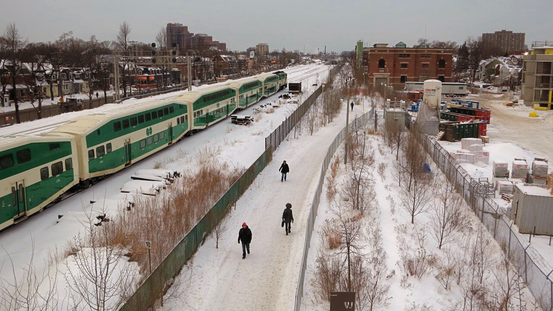
1. Below is an admittedly bland photo (of my own) of a small portion of western Toronto, however there is plenty of potential information here. There are four dynamic activities taking place from left to right: a mid-sized residential street, a mass transit rail line, a pedestrian path, and a construction site. 2. I chose this image because there are four bits of invisible information apparent here, again from left to right: vehicular and pedestrian traffic on the road; train activity and passenger activity on the rail line; walking/cycling activity on the pedestrian path; and redevelopment of a low density residential site to a medium density residential site. 3. All four bits of invisible information could contribute to future urban planning decisions in this area of high activity in western Toronto. Specifically for example, the recreational path only runs for 2km between two rather unimportant point on the railway (from one low density residential area to a very low density industrial area). A survey can (and should) be taken to determine how much foot and cycle traffic, and for what purpose (recreation or commuting) passes over this short 2km trail, to determine if it would be worth extending the path for an additional 2km along the railway to a much more important commercial area, where many people also work, thereby possibly getting more people to walk or cycle to work rather than drive. Success with this information would be predicated however on convincing the rail line owners to give up some of their right-of-way to a new trail, though if the invisible information discussed could be visualized or made more concrete, that should help sway them. ![WRT][1] [1]: https://edxuploads.s3.amazonaws.com/14297662369534504.jpg