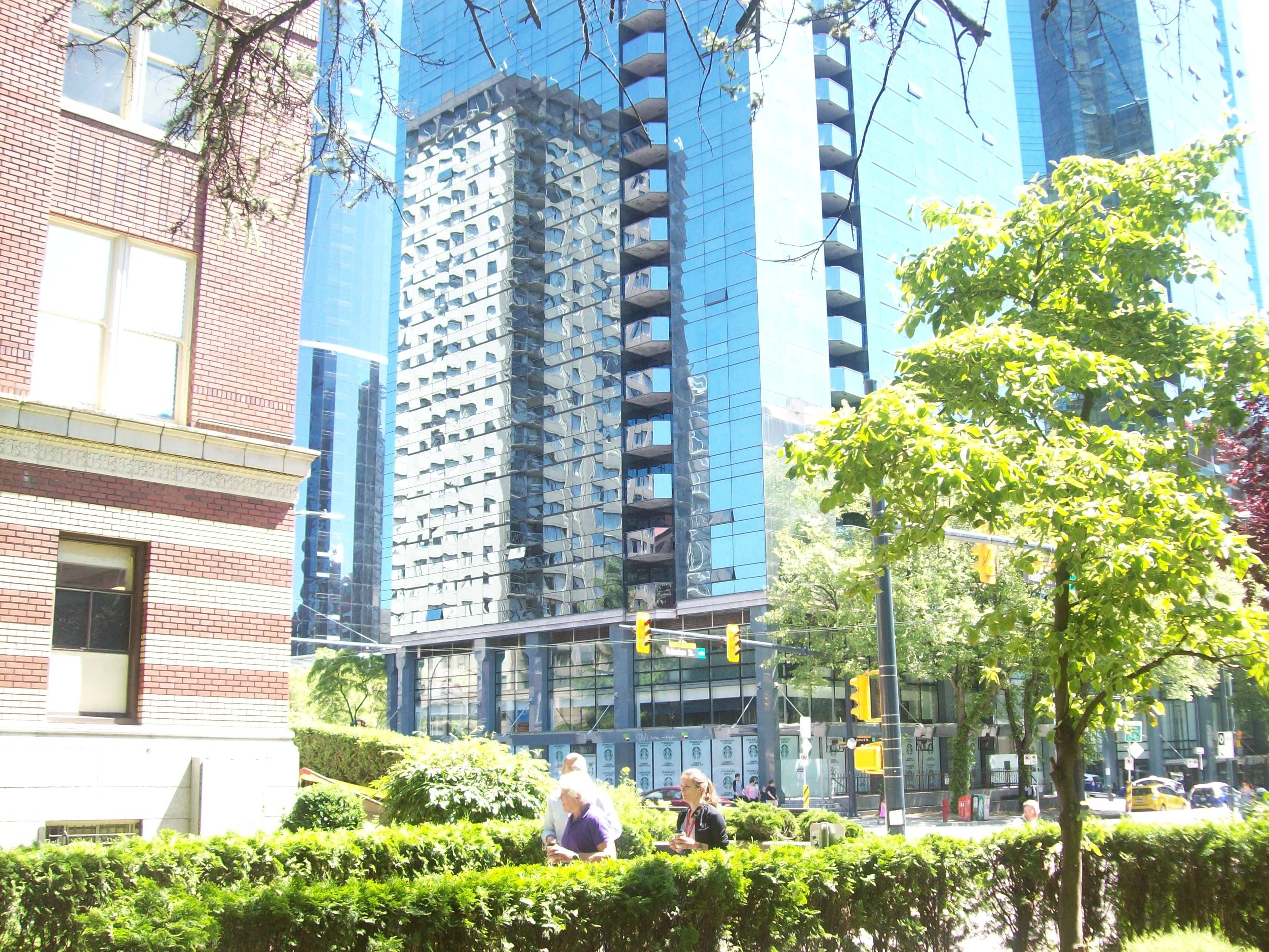
Making invisible visible - Burrad Street, Vancouver, Canada
FC-01x Future Cities (1st Run) - Exercise 1 : "Making the Invisible - Visible"

Uploaded on 2015-06-09 by Harit_a
[1]: https://edxuploads.s3.amazonaws.com/14338113097795618.jpg This is a photograph from CBD-Vancouver, Canada. It is taken from under the Hippocratic Plane tree, in the entrance courtyard of the Saint Paul's Hospital, on Burrad Street. On the left, one can see the beautifully crafted brick and stone facade of the historic St. Paul's hospital building. In the middle one can see the all-glass facade of the Shereton Wall tower reflecting some other older towers. At the base of this tower is the signage of the soon-to-be-opened Starbucks just under the traffic control signal lights. On the right – in the foreground is a small tree echoing the main Hippocratic Plane tree (some tips of the branches are visible at the top of the picture) – in the background are the parked taxis and cars. At the bottom of the picture is the hedge lined entrance walk way where patients, their visitors, doctors, staff, etc. go back and forth 24/7. The two invisible information made visible are as under (1) The walkway and traffic control signals – indicating “the flow” (vehicles and pedestrians) (2) The three time-events indicating the different times the city has passed through – (a) the brick and stone of the St. Paul's (early 20th century) (b) the concrete frame and stucco finish of the older tower seen in the reflections (1970-80) (c) the steel and reflective glass of the Shereton Wall (2015) Both these invisible information can be turned into knowledge by collecting it as data and analyzing that data. The data on traffic and pedestrian flow can be collected by using automatic sensors. We can find out about the hourly numbers, the average speed, etc. of the vehicles passing on the Burrad Street at this point. Similarly, from other sensors, we can find about the number of people entering and exiting from the walkway to the St. Paul's Hospital. This knowledge can then be used for developing the future traffic and density plans. Also, from the data available in the development approvals issued at different times, we can study the building area, the construction materials, the approved / permitted usage, etc. of the various lots and land-parcels on the Burrad Street. This can help in getting a better understanding of the changes in demands and usage across time. Thus we can make the invisible become visible.