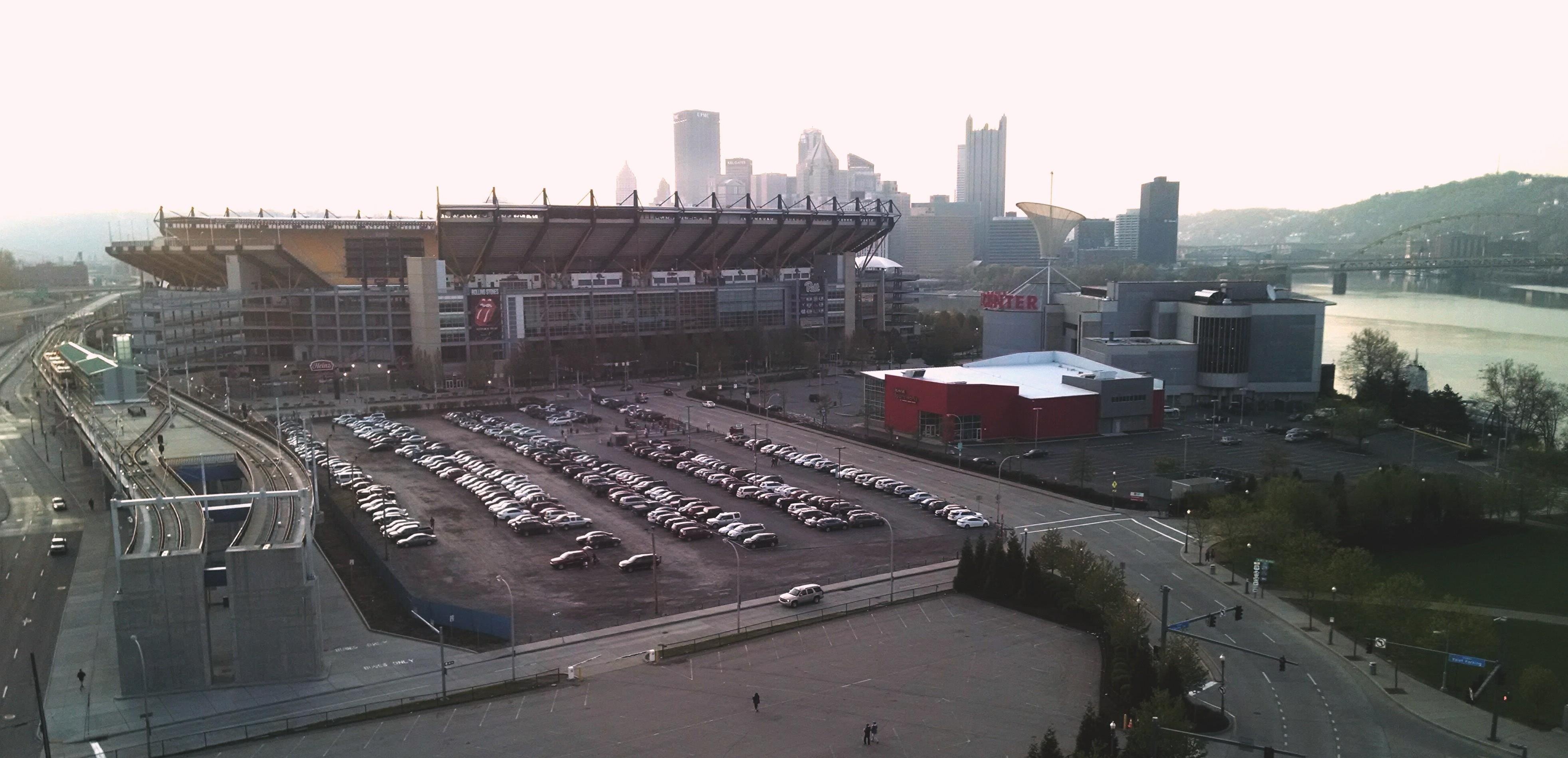
Pittsburgh Pennsylvania US - underdeveloped public transit
FC-01x Future Cities (1st Run) - Exercise 1 : "Making the Invisible - Visible"

Uploaded on 2015-05-11 by martinecarney
[1]: https://edxuploads.s3.amazonaws.com/14313197359448526.jpg Seen is the terminus of a light rail line just outside of Pittsburgh's city center in an area that servers as a sport and entertainment complex. Visible are River(s) and hills that create barriers to transit, adding expense to rail and road projects by requiring the construction of bridges and tunnels whenever regional transportation projects are planned and funded. This particular spur is an extension of a light rail system that serves communities south of the city center (beyond the hills seen to the right of the image). Currently fares to the city center are free to promote use of the train and it serves as a conveyance for workers from the ample parking in the vicinity of the sports and entertainment complex to the offices that generally see higher traffic at times when the sports entertainment complex is idle. If Their are parking solutions in the city center (or elsewhere on the rail line perhaps at reduced cost park and ride lots) that can serve the congestion in the area of the Sports and entertainment complex when it sees heavy use, and the train can serve to shuttle people to one area or the other as the use patterns of those parts of the city change, there is a possibility that a system can be developed to alleviate congestion in this area of central concentration. Invisible is whether the train system can handle the volume of people that would need to be transported to realize this relief of congestion in these areas that see some of the highest congestion in the region. Also invisible is whether this system will serve the residents of communities north west and east of the city center that don't have light rail service to their neighborhoods. A program that varies the number of trains and offers temporary free or reduced parking in various places along the train route along with transit hubs labeling and routing information to connect residents in the east and west that have more developed bus transit, along with monitoring of the car travelers to determine who is coming from where to utilize these facilities during periods of peak congestion could lead to a further improvements projects that give the greatest benefit for the transit system by obtaining higher levels of ridership to support the infrastructure costs.