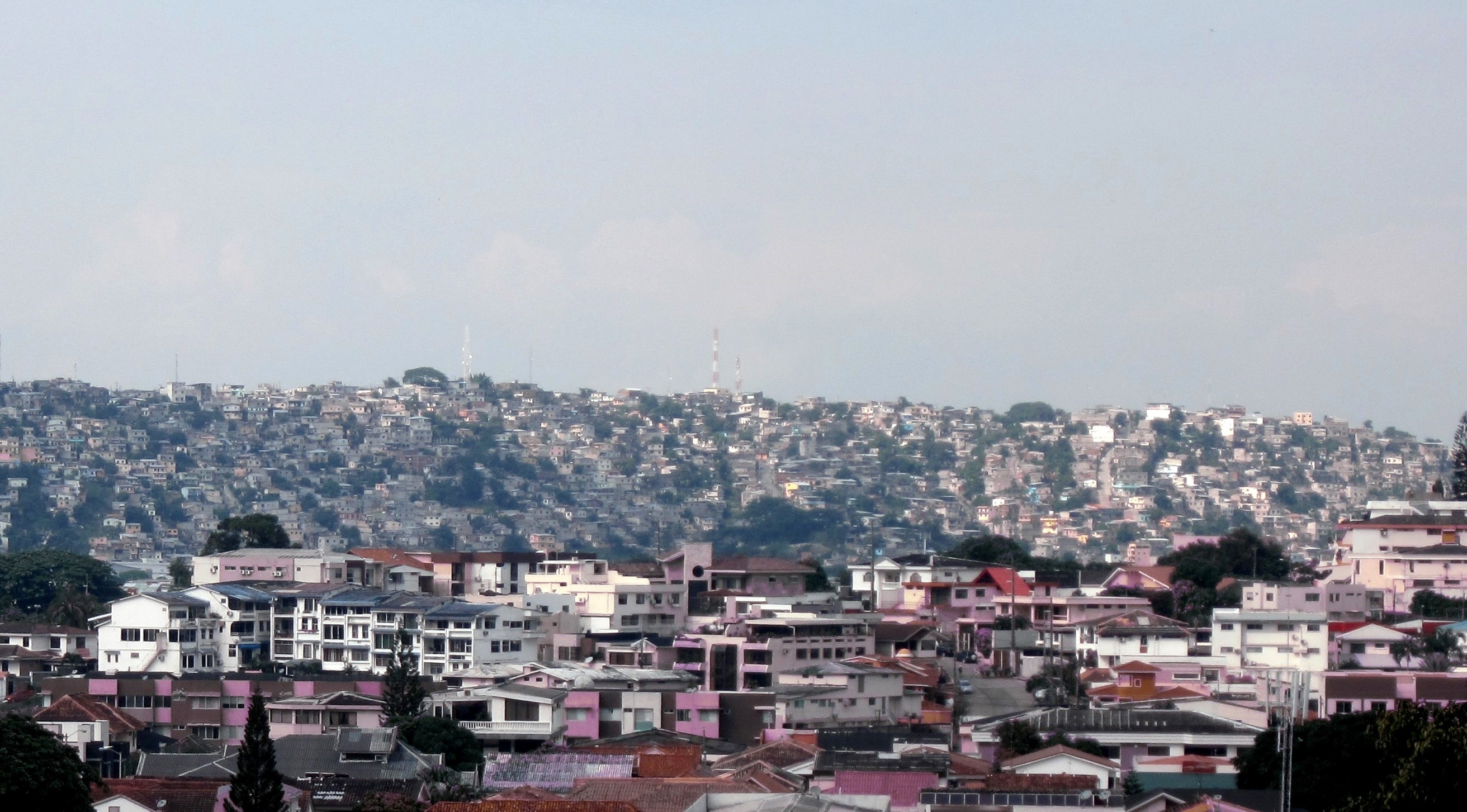
Guayaquil, a dual city
FC-01x Future Cities (1st Run) - Exercise 1 : "Making the Invisible - Visible"

Uploaded on 2015-04-20 by luisproano1
The photo was taken in Guayaquil-Ecuador, and shows two different urban settlements located in the north-western city. The settlement bellows correspond to the neighbourhood Colinas de los Ceibos, lodging concrete buildings and houses with well-painted walls, elegant tiled roofs and road infrastructure; whereas, the settlement behind and bordering Colinas de los Ceibos is known as Mapasingue Este, a settlement owing rustic houses made of wood, reed and of mix construction with zinc, plastic or wooden roof. The first information extracted from the picture is that it is a dual city, the front urban settlement belongs mid to high-class stratum’s families with urban services, whereas the location behind belongs to informal settlements lacking of many urban services (infrastructure and urban facilities), who occupied the previous rural lands along the Daule Avenue since 1980. The second information being inferred is that this kind of urbanization has occurred due to lacking of effective urban planners and managers decisions and by political reasons that stimulate the illegal appropriation of rural lands for many decades. By counting on well-prepared urban professionals and managers, the second visible information, we could considerably achieve a better liveable urban space for those poor families located on the higher hills (Mapasingue, Flor de Bastión, Monte Sinaí, Voluntad de Dios, etc.). Sound strategies of rehabilitation in Mapasingue with sustainability criterion could help informal settlements and urban service-non-access families to incorporate them to the formal city through new public green spaces, mobility infrastructure, urban facilities, commerce, business offices and dwellings not only for current neighbours but for Guayaquil’s future growth. [1]: https://edxuploads.s3.amazonaws.com/14295360206553509.jpg