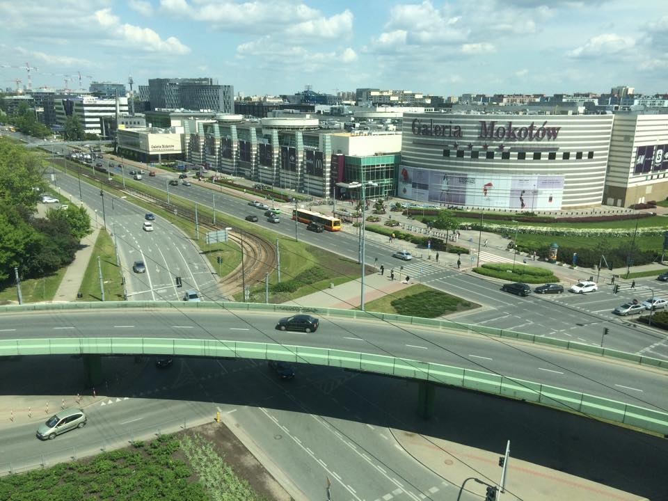
Office District Warsaw, Poland
FC-01x Future Cities (1st Run) - Exercise 1 : "Making the Invisible - Visible"

Uploaded on 2015-05-22 by JacekKaras
[1]: https://edxuploads.s3.amazonaws.com/1432289446944104.jpg 1) The following information is visible in the photo: - road traffic - streets structure (inner city roads vs. part of city ring road that is visible at the bottom of the photo) - bike lanes - shopping mall - bike station in front of the shopping mall - office buildings in the background - parking space (left side of the photo) - housing units in the deep background of the picture - clouds (will it rain?) 2) invisible information: - patterns of car traffic - patterns of human traffic - energy consumption of buildings - bike congestion 3) making invisible visible - bike congestion Shown part of the city is the office district. In term of traffic congestion the following logic applies: traffic peaks twice a day - in the morning (when white collars commute to work) and in the afternoon (when people commute back home). Most people commute by public transport or by car and a limited number by bike. That is reflected in the congestion of automotive traffic in the peak hours. However, the number of bikers as commuters is growing. Combined information (car traffic congestion vs bike traffic). As the car traffic is dense in the peak hours, biking could emerge as a sensible alternative. The invisible information could reveal that there is already more bikes than bike stations could accommodate and there is a need for more of them. So as the number of bike stations grow, the number of cars on the roads decrease. This shift would mean a number of changes to accommodate growing number of bikers - e.g. narrowing roads to widen bike lanes, reconstruction of road and lanes junctions to protect bikers, building bike lanes to the District to provide easier access for bikes and so forth. All that would result in more sustainable living for office workers - health benefits from biking and less CO2 from car traffic.