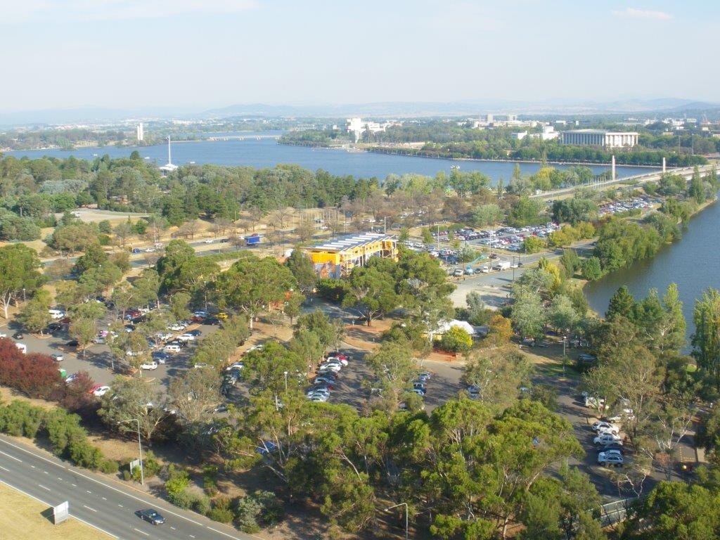
Canberra - City to the Lake - invisible visible
FC-01x Future Cities (1st Run) - Exercise 1 : "Making the Invisible - Visible"

Uploaded on 2015-06-14 by SteveWallace
This photograph was taken from the top of a relatively new apartment block at, but looking away from, the edge of the central business district (CBD) of Canberra, Australia. **Visible:** In the foreground is a carpark and temporary yellow “pop up” buildings used for events. The photograph was taken on a weekend when an event was happening, so the carpark is full. The area is next to Lake Burley Griffin, which is surrounded by extensive parklands, as can be seen in the upper part of the photograph. A slightly-lowered freeway (in the photograph bottom left) creates a barrier for movement from the foreground area to the CBD (out of picture left). It is proposed to develop this foreground area as a residential and commercial mixed-use and foreshore park precinct called City to the Lake, with a proposed tram line adjacent. See video - https://www.youtube.com/watch?v=TDWUaaaYsF0 For the development to be attractive and popular, it is important that it is connected and integrated with the CBD. This connection should not only be physical, but also visual, so that people can see the lake along the linking streets from the CBD, without, say, having the view blocked by humped bridges over the freeway. To maintain this line-of-sight, the current freeway must either be raised to the surface with at-grade intersections with the lake linking streets, or lowered into a trench with the lake linking streets passing over on bridges at the current/ natural surface level. **Invisible:** The lake is artificial and is in the flood plain of a formerly small river. The original planning of Canberra 100 years ago envisaged extending the city area to the lake included developing this area as part of the city. Nevertheless, in the 1970s, the freeway was built, and largely isolated the foreground area from the CBD. Major utility services pass under the freeway, and would need to be relocated, in 3 dimensions, in line with any changes to the freeway alignment. Current traffic and utility services design and data are available for this part of the city. Simulations of the effects of various freeway re-alignments have been carried out, which converts current data to information regarding the options being considered. **How this invisible information can become knowledge and contribute to the planning of a more liveable urban space:** The information resulting from previous planning and design, from simulations of various options, and feedback from public consultation can be developed into sound knowledge of the capacity and cost estimates for the development of the site. To date, it is likely that re-locating the freeway to a surface road with at-grade intersections would satisfy neither traffic capacity nor noise requirements, nor reduce the sense of a barrier (caused by the high freeway-surface road cross traffic) between the CBD from the lake. On the other hand, the freeway trench would be quite expensive. Full consideration of the knowledge gained would contribute to the planning of a potentially highly liveable urban space. [1]: https://edxuploads.s3.amazonaws.com/1434195437965107.jpg