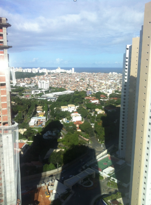
Invisible/Visible Salvador,Brazil
FC-01x Future Cities (1st Run) - Exercise 1 : "Making the Invisible - Visible"

Uploaded on 2015-04-22 by MagAtala
![digite a descrição da imagem aqui][1] 1- This photo was taken in the city of Salvador, Bahia. Brazil. 2- In the foreground we can see that this picture was taken from a tall building and this building produces a large shadow in the nearby area. The invisible information in this case refers to land use. What was once an area predominantly occupied by residences, is being occupied by high-rise condominiums. In the background we see another residential pattern and other urban scale. The streets do not follow a set pattern. The invisible information contained in this area relates to irregular occupation of the land area. In this area the less favored classes randomly build their homes, often without access to basic sanitation and public transport. 3- One piece of information that can be used for future planning refers to the climate. Salvador is a city of tropical climate. The change of a wooded area to a neighborhood of large buildings generate a large change in climate making this área more arid and hot. This will also generate a large population increase. [1]: https://edxuploads.s3.amazonaws.com/14297159521135012.png