Making the Invisible Visible--Ottawa
FC-01x Future Cities (1st Run) - Exercise 1 : "Making the Invisible - Visible"

Uploaded on 2015-06-16 by sebady
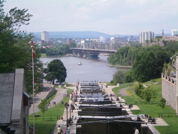
The **visible** information apparent in this photo is the Ottawa River and the Rideau Canal (as well as the Locks on the Canal). In the horizon, we can see the bridge that connects Ottawa to Gatineau, and we can also see some of the Gatineau landscape, including mountains and various commercial and government buildings. Additionally, this photo demonstrates the abundance of green space in Ottawa, which is even prominent in the downtown core. Finally, the photo provides visible information regarding roads and pedestrian pathways. The **invisible** information that can be extracted from this photo include pattern of movement (pedestrians and traffic) as well as pollution in the water. With regards to using invisible information as knowledge for planning a more liveable urban space, understanding the effect of polluted water is essential. Because of the poor quality of the Ottawa River water, E.Coli levels tend to be high at times, which poses a health risk to the natural habitat and the citizens (as the Ottawa River is a source of drinking water). Urban planners and policy administrators must devise action plans to ensure that sewage is not dumped into significant bodies of water. ![enter image description here][1] [1]: https://edxuploads.s3.amazonaws.com/14344158738004103.jpg