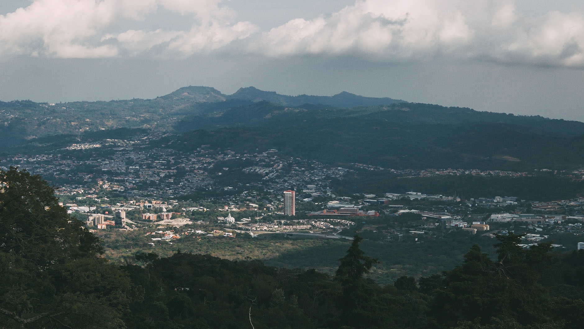
Antiguo Cuscatlán-Santa Tecla-San Salvador
FC-01x Future Cities (1st Run) - Exercise 1 : "Making the Invisible - Visible"

Uploaded on 2015-04-23 by marcelm02
[1]: https://edxuploads.s3.amazonaws.com/14297509409681282.jpg The image was taken from the San Salvador Volcano, I particularly like this panoramic view because ti shows three cities that have joined together in the past ten years. On the visible information about those cities, is quite interesting to see how the majority of the buildings are low high, being just one the exception that excels beyond the rest. The tower named Torre El Pedregal, which totally residential by the way, has 28 floors and around 110m high being the tallest in the country and the whole Central America. Besides that, all the low high building that are visible at the center are mainly residential, commercial and university campuses, and completely residential at the borders. As you see, the cities are located at the center of many mountain ranges and volcanoes, defining the shapes and limits of the future expansion. Related to the invisible information, as I mentioned at the beginning, there are three cities in the photo, that seem to be one big site (on terms of the countries extension, around 21,000km2) and even though for me is kind of difficult to identify the limits from one to another. On terms of high, isn’t the fact that we experiment a lot of midrange earthquake the one that limites vertical development, it is actually a social perspective of ownership and safety those that motivates people to keep themselves as near as the ground as possible. I mentioned ownership, because the vertical living isn't particular cheap, for example, an apartment on Torre Pedregal costs around US$500,000 which compare to the minimum incoming in the country (US$200- US$250) isn’t reachable at all, also, the houses located at the borders and up the mountains are around the same cost which force the majority of the people to live in areas far away from the main cities, around 20km to 25km distance. Around 65% of the people that work on those three cities live outside of them simply because the high and expensive cost of living inside them. To better understand the disproportion of land occupancy, almost 300,000 people live in Soyapango ( located 25km east, away from the cities at the photo) which has a 29,72 km² extension with a density of 9,771.6 hab/km², compare with this three cities that have around 127km² extension 135,000 inhabitants and a density of 1207,51 hab/km². Which are the main reasons that invisible information is so interesting? Certainly the invisible information speaks so much more information that the visible does about the city, because as my example of city, the first invisible information on it is the fact that those are three cities showing but is not perceptible unless by my comments about it, another important fact is that with the invisible information we can deeply describe the ways and reason of the people to live or not inside those cities. We can also understand the expansion of the cities and the low high buildings, we determinate the projection of the future of the cities and the inhabitants.