Pancevo City Center
FC-01x Future Cities (1st Run) - Exercise 1 : "Making the Invisible - Visible"

Uploaded on 2015-06-16 by skosamer
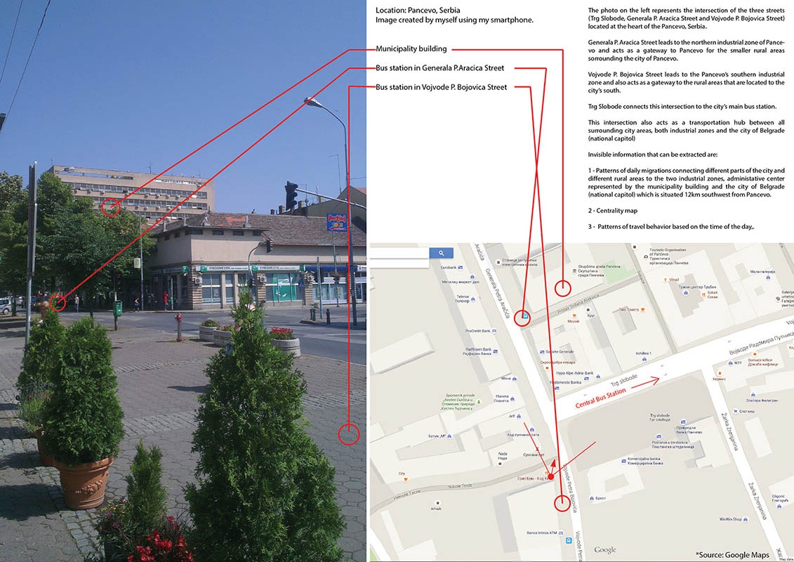
[1]: https://edxuploads.s3.amazonaws.com/14344351496953819.jpg The photo represents the intersection of the three streets (Trg Slobode, Generala P. Aracica Street and Vojvode P. Bojovica Street) located at the heart of the Pancevo, Serbia. Generala P. Aracica Street leads to the northern industrial zone of Pancevo and acts as a gateway to Pancevo for the smaller rural areas sorrounding the city of Pancevo. Vojvode P. Bojovica Street leads to the Pancevo’s southern industrial zone and also acts as a gateway to the rural areas that are located to the city’s south. Trg Slobode connects this intersection to the city’s main bus station. This intersection also acts as a transportation hub between all surrounding city areas, both industrial zones and the city of Belgrade (national capitol) Invisible information that can be extracted are: 1 - Patterns of daily migrations connecting different parts of the city and different rural areas to the two industrial zones, administative center represented by the municipality building and the city of Belgrade (national capitol) which is situated 12km southwest from Pancevo. 2 - Centrality map 3 - Patterns of travel behavior based on the time of the day.