Making invisible - visible. Roma, Italy.
FC-01x Future Cities (1st Run) - Exercise 1 : "Making the Invisible - Visible"
Uploaded on 2015-04-30 by ppereiramaria
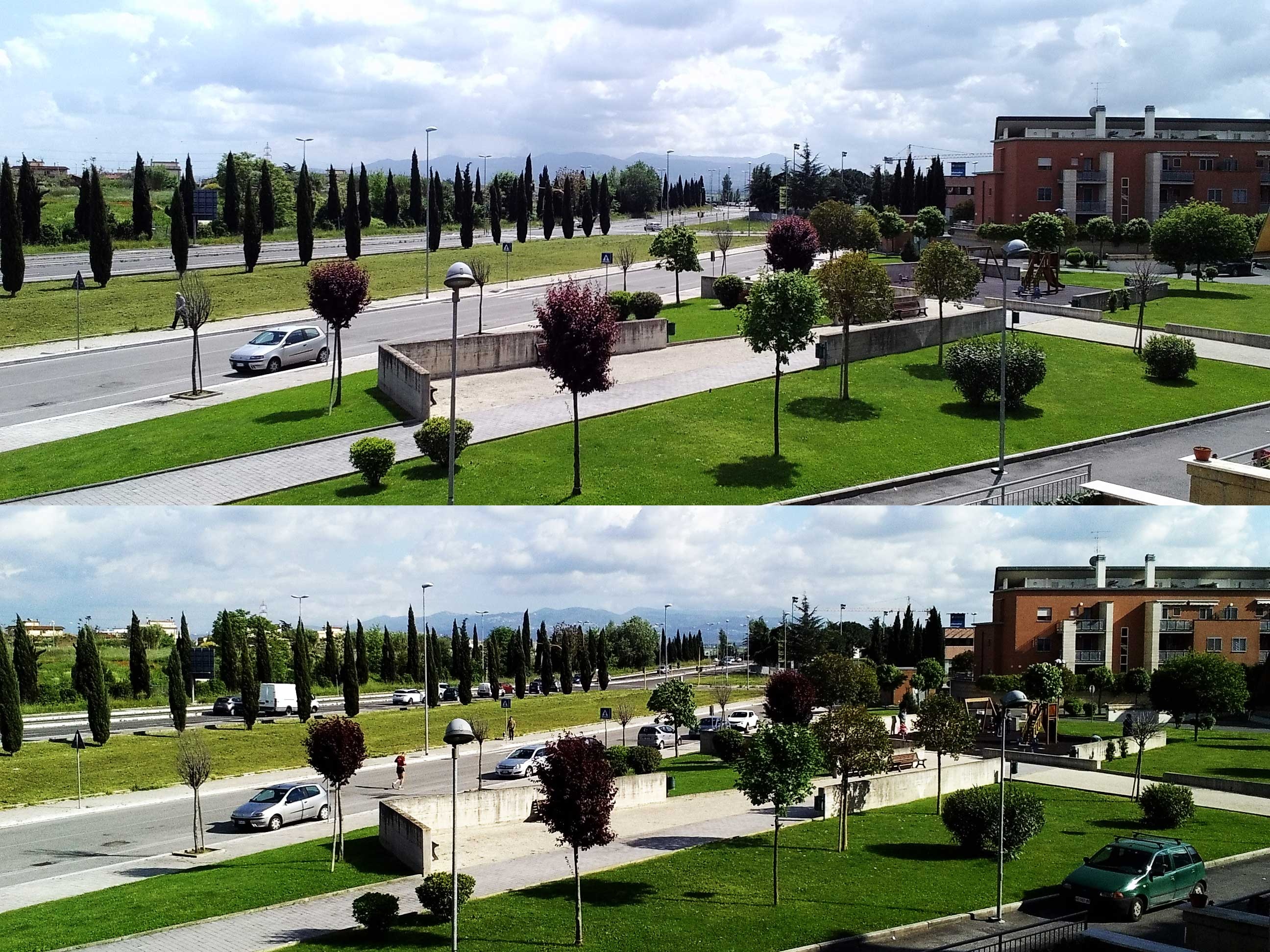
The urbanization of this photos is situated outside the ring of Roma. The first picture was taken at 11:00 and the second one at 17:00. **1.- Comment all the information that is visible in this photo.** There are two parallel roads, external with more traffic, sidewalks and a green area. In the background there is a crane. We can see different scales of buildings. Closer are those of the new urbanization and to the left of the photo, a little further away, smaller houses. It is possible to differentiate variety of materials (brick, glass, precast concrete). Signal lights at the crossroads, signage, street lighting… In the morning an elderly man walking and there are fewer cars. In the afternoon a man running and children playing in the park. **2.- Identify and present two "invisible information" that can be extracted out of the visible information of this photo.** Of the visible information "Two parallel roads", I extracted the next invisible information: The nearest road is only used by the residents of the complex, is internal traffic. The outer road leads to the "tangential" a road that takes you in a short time to the center of Rome. This has a very high flow no cars but is continuous. On the contrary, internal road is used for running and biking, road traffic is only for entry and exit. Of the visible information "people and cars in the photo", I extracted the next invisible information: It is an area of life, no work (in the morning there are only older people, in the afternoon there is more life). People leave their homes in the morning in their car (In the morning there are no parked cars and the evening is full). Infrequently used public transportation. The public areas of urbanization work well. People go running, walking or cycling. The children play in the park. Parents talk sitting on public benches. **3.- Select one of your choices from the previous question and describe how this invisible information can become knowledge and contribute to the planning of a more livable urban space.** It is an area of life, no work but all the people use their car to get to work and infrequently used public transportation. Why? After several uses of public transport, I think in diverse options. There is only one bus line that goes through the complex. This bus takes you on a road that is always full of traffic. To get to the subway, it takes 10min on motorcycle but by bus you can take 1 hour. With the car, you can take the "tangential" (fast road that takes you to the center) so near and it takes 30 min to be in the center or 10 minutes to reach another subway station. So it is normal that people do not use that bus. To improve this, should study the option of changing the bus line or improve the traffic on the road which is always jammed. The invisible information leads to pinpoint problems, to improve the existing and planning new things with the knowledge that work well. [1]: https://edxuploads.s3.amazonaws.com/14304134762519365.jpg