EXERCISE 1: Making the invisible – visible, Utrecht, the Netherlands
FC-01x Future Cities (1st Run) - Exercise 1 : "Making the Invisible - Visible"

Uploaded on 2015-05-10 by RikHartog
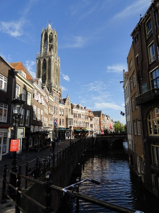
![Picture taken by: R. Hartog; Location Coordinates: 52.091383, 5.120043; Location description: Dom Church & Vismarkt, Utrecht, the Netherlands][1] **Picture taken by:** R. Hartog; **Location coordinates:** 52.091383, 5.120043; **Location description:** Dom Church & Vismarkt, Utrecht, the Netherlands. **1. The visible information:** This picture was taken while standing on a bridge above one of the canals of the city of Utrecht. One of the largest churches of the Netherlands, the “St. Martin's Cathedral” also known as “Dom Church”, is shown. The Dom Church is located in the centre the city. The shops on the left side are part of one of the oldest shopping streets of the city. This street is accessible for cyclists and pedestrians only. The canals are used for cruises with small boats. **2. The invisible information:** The first invisible information that can be extracted out of the visible information of this photo, is the behaviour pattern and density of the cyclists and pedestrians at a different time of day, month or year. The second invisible information that can be extracted, is the behaviour pattern of the customers and their lifestyles, based on their social class, age, gender, etc. **3. The planning of a more liveable urban space:** The invisible information can become knowledge by observing the behaviour pattern of the customers and their lifestyles. This knowledge could be used to predict which buildings are suitable to create a more liveable urban space. [1]: https://edxuploads.s3.amazonaws.com/1431260490447038.jpg