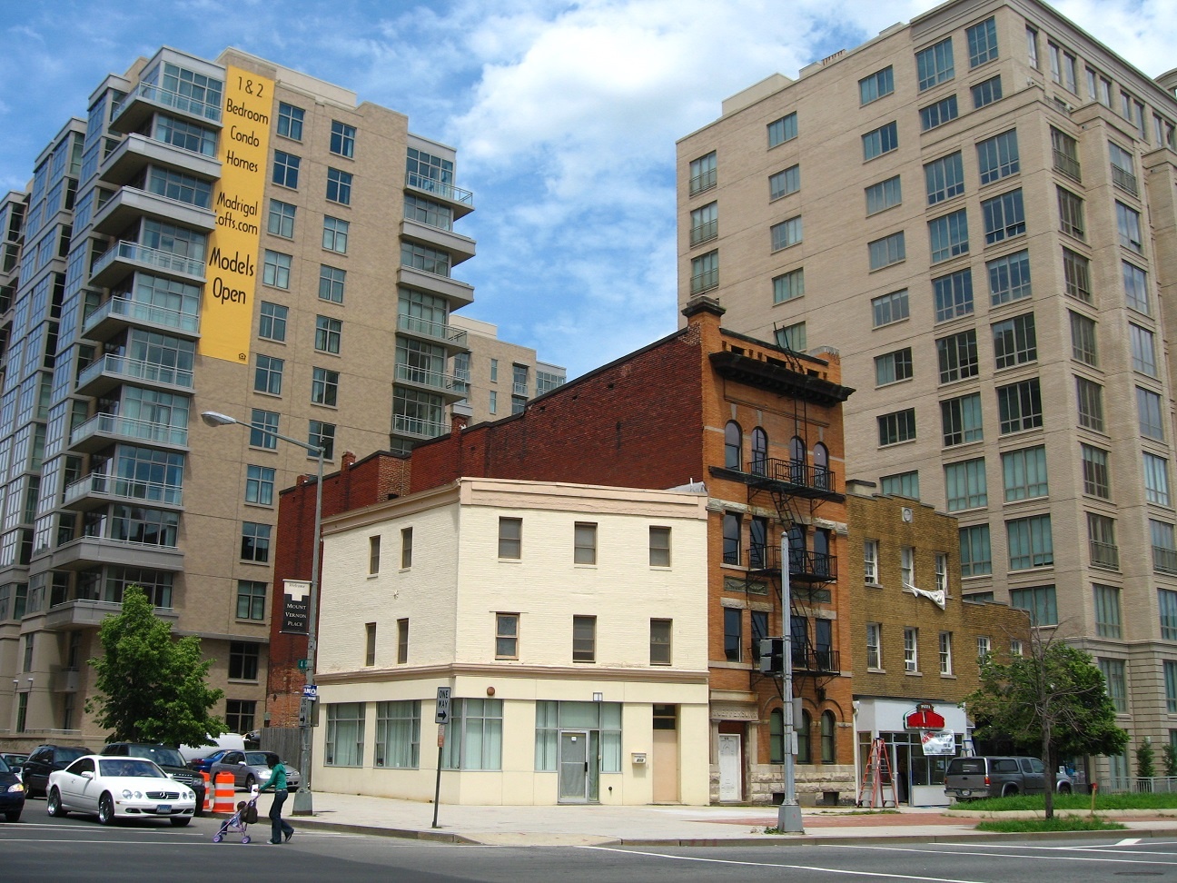
United States, Washington DC housing displacement
FC-01x Future Cities (1st Run) - Exercise 1 : "Making the Invisible - Visible"

Uploaded on 2015-05-07 by dlestabrook
During a stop in Washington D.C., I happened to take this photo , positioned roughly ten blocks east of the White House, showing new development wildly out of scale from the existing 19th and early 20th century architecture. After searching for Madrigal Lofts just now, I located the exact block and amazingly, those three historic buildings are still extant. The visible information relates the story of urban densification strategies in taking less expensive and underutilized parcels to promote development. > However, two pieces of invisible information are also evident. The 2008 image shows a resident crossing the street with a stroller. She passes in front of a Mercedes Benz and Range Rover, obvious indicators of the gentrification to occur in this neighborhood. Did developers or planners account for the displaced residents, or were they left to seek affordable housing on their own? Secondly, with the increased density, where are the new occupants shopping? In the previous historic building stock, functions were integrated, with first-floor space reserved for retail and the upper floors for offices or residential space. Now, these urban lofts appear primarily residential, so it would be beneficial to understand how far their occupants travel to obtain groceries, household goods, etc. [1]: https://edxuploads.s3.amazonaws.com/14309626211940528.jpg