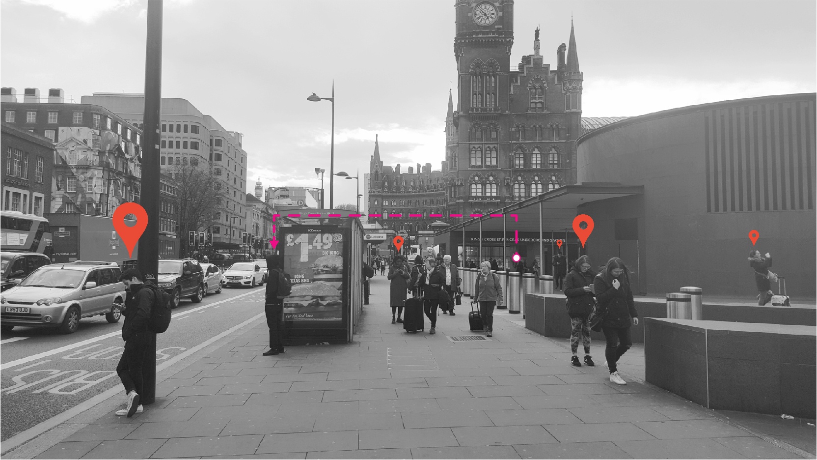
King's Cross, London, UK.
FC-01x Future Cities (1st Run) - Exercise 1 : "Making the Invisible - Visible"

Uploaded on 2016-04-30 by HughEbdy
1 / Visible Information The viewer looks down a wide, busy pavement. To the right of the pavement sits the edge of a public plaza and to the left a busy road (bordered by 5-9 storey buildings on the furthest side). One can assume from the luggage pulled by various pedestrians (and that the only people standing still are either on their phones or waiting at the bus stops) that this might be something of a transport hub (and a thus a through-route) – an entrance in the centre-right of the photograph to ‘King’s Cross St Pancras Underground Station’ would confirm this after a quick internet search. The photo could then be placed in Central-North London, UK. From a knowledge of location, you could determine that the building with the clock tower is the St Pancras Renaissance Hotel (the frontage to St Pancras International train station, which shares the plaza on the right of the photo with King’s Cross station (out of view)). The road on the left would then have a name; Euston Road – which runs along an east / west axis. The time on the clock-tower reads 16:53. A ‘Long Texas BBQ’ from Burger King is only £1.49 (for a limited time). 2 / Invisible Information - London’s public transport system runs on Oyster Cards (a smart card); so there is the potential to therefore trace journeys across London in real-time. - Locations of phones can be combined with search data (for example, in google) to produce top searches by specific location – for example one could learn what is most searched for when people stand by the bus stops (and from this determine what people find confusing about a certain location). 3 / Potential From personal experience I know that people will either take a bus or a tube (metro / underground train) to get somewhere but rarely use both means of transport in the same journey (unless travelling to more obscure places outside central London – inside central most people ‘take a bus and walk’ or ‘take a tube and walk’ or ‘hire a bike and walk’). Here in the photo we see both bus stops and an underground station (bike hire spot is nearby) - but because of its centrality I would doubt many people connect from one to the other as there is simply no need. It would be interesting to find out which destinations further out of central London require more than one form of transport (rather than a connection within the same system) – one could build up a map of interactions between the various modes of transport and such information could be used to inform the creation / expansion of existing lines / new transport initiatives. [1]: https://edxuploads.s3.amazonaws.com/14620440909468214.jpg