Uploaded on 2014-12-08 by Lance101
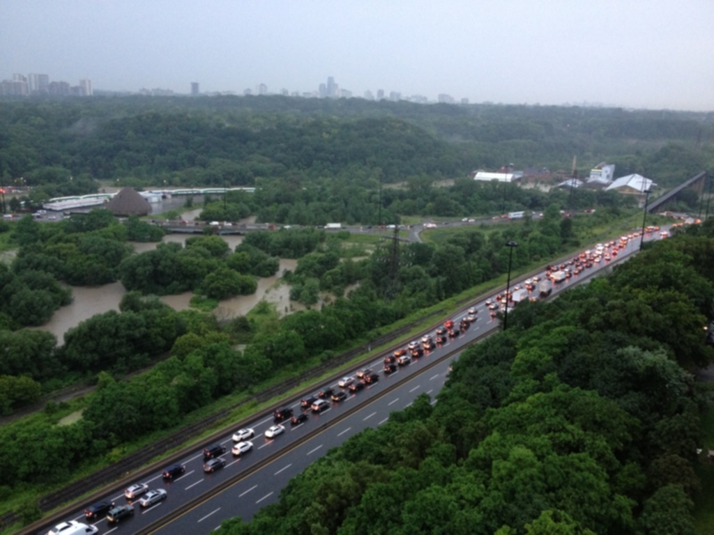
[1]: https://edxuploads.s3.amazonaws.com/141801443444985.jpg This is Toronto's only north/south highway known as the DVP (Don Valley Parkway). It is built into a natural valley that runs through the city from Lake Ontario. What is left of the original Don River still flows through the valley a slow and shallow rate. When it rains, the Don River swells from water following its original natural course. In the summer of 2013 we had a torrential downpour of biblical proportions. In the span of 4 hours we had more rain than we would normally have for an entire month. It caused massive flooding all over the city and shut down the highway. The traffic in the picture shows all of the vehicles driving in the opposite direction due to the highway being shut down due to flooding. With no alternate highway route and most of the city streets also flooded, most drivers took up to 6 hours to cover what would normally take an hour or less in their commute to get home. It took more than 4 hours just to get all of the cars off the highway.