A Village Annexed
FC-01x Future Cities (1st Run) - Exercise 1 : "Making the Invisible - Visible"

Uploaded on 2014-12-09 by Manualej
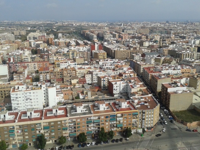
[1]: https://edxuploads.s3.amazonaws.com/14181108563518118.jpg This picture was taken from the terrace of Hotel Eurostars Gran Valencia, overlooking the roundbout at the intersection of Carrer de la Safor and Av. De les Corts Valencianes, at Benicalap, Valencia (Spain). A. About the visible aspects of this district, we found two important aspects: (1) One is little difference in characterization of urban area. (2) And another is the garden-city that is in the area relationship. At the bottom of the image we find the presence of green space not attached to the urban area. Benicalap and urban organization was based on the canals of Rascanya, resulting paths to the garden respecting them, but when it was absorbed this relationship was disappearing. B. On the other hand, the invisible information present in this picture that I appreciate a low number of people visiting this area when we compare it with the center, in an Urban centrality map of Valencia surely would find low levels. Benicalap district was a village that was annexed to the city in the late XIX century, but continue with the same flow commercial low and touristic, and it’s because didn’t incorporate any equipment or large projects. In conclusion, a village annexed to a city never get the features or the same influence of a city without urban redevelopment necessary, but this would mean his personality and relationship with the past, being covered by a layer of "modern style", as if a coat of paint to lie down on a ancient artwork.