Hidding on evolution.
FC-01x Future Cities (1st Run) - Exercise 1 : "Making the Invisible - Visible"

Uploaded on 2014-10-28 by XoseSanchez
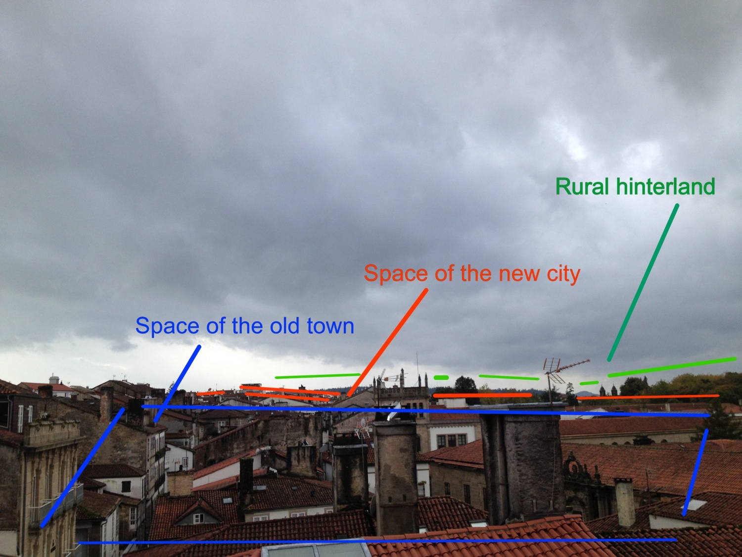
1.- Form, shape, map, urban development of cities is the conclusion of many years, centuries in many cases, of developing and history. From one window, in our city, Santiago de Compostela, we see one semi-bucolic landscape, as he old town lays on our view, with its medieval origins, surrounded by churches (mainly urban centers on Middle Ages) and some relatively high buildings; it is combined with green zones and leisure spaces. Ww see one actual city that came from the past. Image: https://edxuploads.s3.amazonaws.com/14144873745787939.jpg 2.- But looking closely we can see the developing of the actual city on different relatively hiding spaces: a) the old town, center of the development, main urban structure on past centuries and touristic centre that carries of the economy not only of the city but of part of the region. Close to it, b) the highest buildings of the new city; surrounding the old town, the new city grown from the '50s and '60s until today, giving new services, most developed economic spaces and more comfortable living and inhabitant zones. And c) surrounding everything that the rural hinterland, giving support to another and different kind of living, with some semirural neighborhoods and agricultural holdings. Heritage, living and economy related in three spaces. 3.- The considering of this relatively invisible information can became extremely important for the planning of the future city. This knowledge is the key to design new urban and more efficient transports that communicates center, periphery and hinterland; is the key to the urban traffic design and, specially to the developing of different economy industries and to the differential promoting of the different areas.