Making the invisible-visible: TRIANA STREET
FC-01x Future Cities (1st Run) - Exercise 1 : "Making the Invisible - Visible"
Uploaded on 2014-10-21 by AlejandroPC
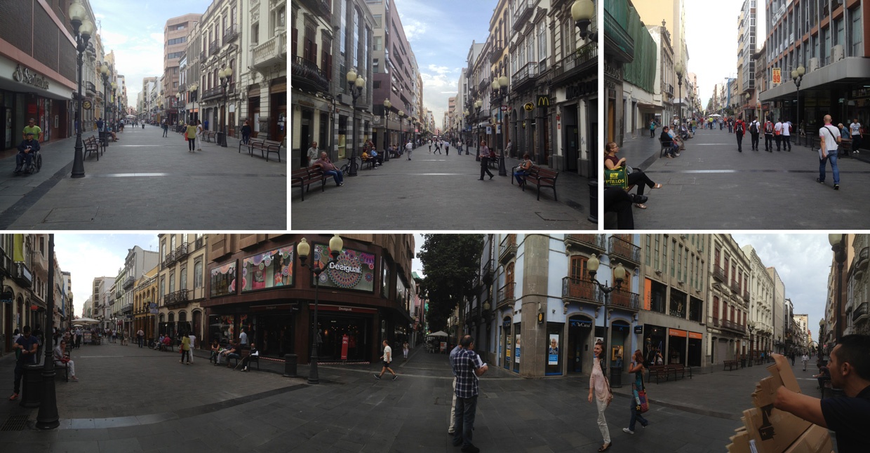
[1]: https://edxuploads.s3.amazonaws.com/14139200482443818.jpg The picture shows several views of the Triana street. This is the main traditional commercial street of my city: Las Palmas de Gran Canaria (Canary Islands, Spain). It´s a pedestrian commercial area: Triana and all the streets that surround it are closed to vehicles. There are several bus stops, taxi stops and parkings around those streets. What is visible are the signals, store windows, benches to rest, trees, bars' terraces, and the different kind of shops and offices (banks, public administration offices,...) The invisible information is what you can extract from the people and their movements and actions during the day, and from the location of the different kind of shops, bars and offices in the area. You can measure how many people walk in Triana on different hours and relate it to the traffic of buses or taxis in the surroundings, and with the demand of parking. You can study how this traffic may be related to air and noise pollution and how to improve (and reducing) the flow of traffic. You can measure the flow of pedestrians on differente areas of Triana during the day, and how it's related to the differents kind of shops, bars and offices. So, you can study how the activities (shopping, eating, business) influence on pedestrians' flow and how this can be used to improve the consumer experience by redesigning of the urban furniture and urban facilities (trees, street lighting, benches, architectural barriers,...) The more data and information you extract the more knowledge you reach to improve the area.