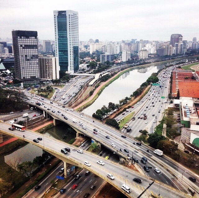
Sao Paulo invisible information
FC-01x Future Cities (1st Run) - Exercise 1 : "Making the Invisible - Visible"

Uploaded on 2014-10-13 by ThatianaP
1) The visible informations in this picture are: we have a lot of buildings and big constructions at this part of the city; the Pinheiros river divides the city in two different spaces; we can see a lot of cars, a train rail and a bike lane (a red line beside the river); to cross de river people have to use the bridges; there's a lack of green areas and leisure areas in this part of the city. 2) Two invisible information are: we have a big accessibility problem between the two parts of the city crossed by the river and the axes of transportation; the big Pinheiros river is polluted, that's why we don't practice any kind of activity on/in it. 3) talking about the accessibility problem, people can't go from the train station to the other side of the river by walking. Moreover, there's no easy way cyclist can access the bike lane, because there's a train rail that isolate it from the neighborhood. Taking this two facts as basis, we can conclude there is no attractive or safe path to the pedestrian or the cyclist in this part of the city. I believe this this problem is deeply related to the infrastructure planning at the hole city and the lack of public spaces that offers leisure and green areas around the river. [1]: https://edxuploads.s3.amazonaws.com/14131579175741806.jpg