Complex system in a still image?
FC-01x Future Cities (1st Run) - Exercise 1 : "Making the Invisible - Visible"

Uploaded on 2014-10-17 by AmrAlQamary
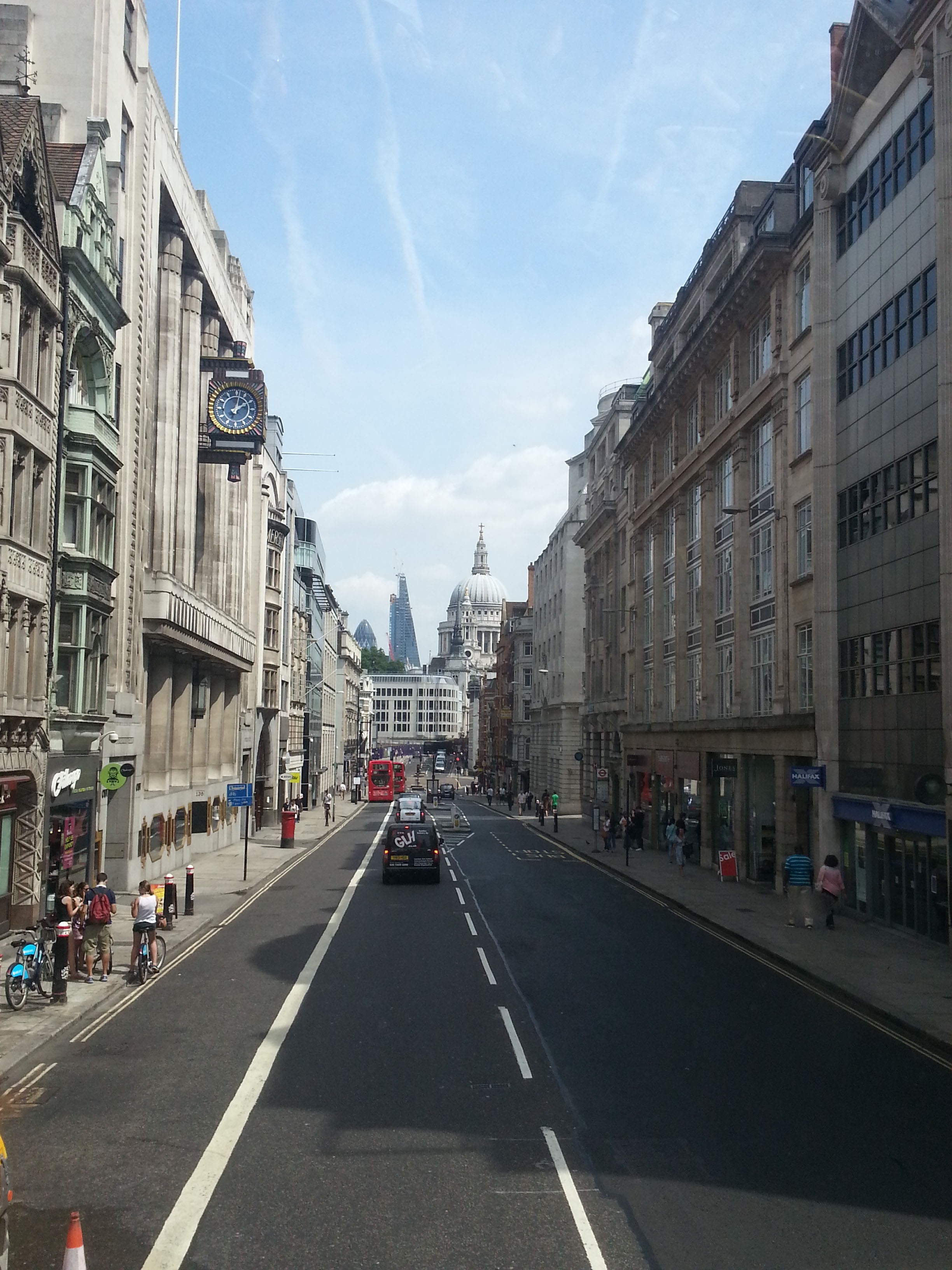
Into the topic, although I believe in the importance of the exercise, It only explores our understanding of the concept of data processing and should not be an application to build up information or contributing a knowledgeable-action-plan to the perceived information. Urban system is a complex one, its problems are wicked one, and the processing framework would differ greatly with different stakeholders and different users. Where every perspective is a small fragment of data, structuring an information processing framework requires an amount of data with different perspectives that would identify the quality and viability of the framework. To validate this point of view, my trial in this exercise would be to extract contradicting information from the same image and build up different scenarios to the following required points. ![enter image description here][1] 1st point; Data: Buildings: different ages, different styles, different nodes, almost same height, same setback, modern iconic buildings, cultural iconic buildings Streets: Narrow street, different furniture ( Watch, Cameras, Integrated lighting with the buildings, way finding map, signage, fire control point, emergency and public transportation lane on the going side, convenient pedestrian side paths , distant crossing points, no cycling lanes People, transportation and usage: Public transportation; Buses, Metro, And Bicycles, in addition to cars. People: almost 20% tourists to the rest seems like residents ( Considering I was in London bus tour) Old to youth maybe less than 5%, and No kids. The buildings in the beginning of the image have their ground floors for commercial usage. Time: Saturday 2.00 pm, July 2013 2nd point; Invisible Information: Neutral information: It's an important circulation axe to reach the historical dome Node. However there are not much touristic activities going on the ground. The traffic can be heavy in the rush hour in the going lane (left) in comparisons to the coming (right) Biased information: The regulations are very considerate regarding building heights, and setbacks. They provide coherent guidelines for the integration between buildings from different ages. Vs The street is losing its sense of place, the usage of buildings as office spaces is causing the street to lose its livability, and the inception of modern buildings and modern materials is causing a loss in the identity. There should be a clear space for cycling in the street; the street is a vital connection. (Public transportation route) Vs The main street is the perpendicular one; this street is secondary in hierarchy. It's used by locals and public transportation to decrease the load from main streets. 3rd point; Knowledge utilization: I'll pick the last information. * The future plans should have induce cycling lanes and parking points in the street, along some additional commercial spaces that targets the community segment that uses bicycles in this area. Vs * There is no need to add bicycle lanes, there is other usable routes. Also there is a need to change the usage of the commercial spaces to be more correspondent to residents needs. [1]: https://edxuploads.s3.amazonaws.com/141354734232658.jpg