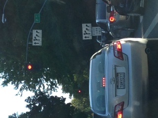
Gridlock in Sacramento, CA
FC-01x Future Cities (1st Run) - Exercise 1 : "Making the Invisible - Visible"

Uploaded on 2014-10-20 by eco-architetto
[1]: https://edxuploads.s3.amazonaws.com/14138437154066932.jpg The picture illustrates a very typical phenomena in this city where there is frequent very visible gridlock. This is due to not having good public transportation and the American way of alway using a car so this is, in fact, the main way people travel in my city. The worst gridlock is in the mornings and in the evenings because people are using there cars to go from home to work and back. It is visible that the roads are not planned properly and increase the gridlock problem. If a model could be made that clearly shows how many single occupant cars are taking particular highways, with where they are going and what they are doing it would make a strong story for citizens and leadership to reduce the carbon footprint, reduce stress and accidents by providing intelligent public transportation (like Singapore). This way the invisible could be made visible showing how changes in the roads could also help alleviate the gridlock. Citizens just sitting in cars going slow, taking 3-4 times longer than necessary to get home is wasting a lot of people's time and energy. By showing the invisible a movement could start to demand better planning that will enhance lifestyle by reducing stress, giving more time with families and greatly helping the environment. I plan to take what I learn from this class to the leadership with recommendation that we study our city in the manner explained in this class.