Exercise 1: Lahore City
FC-01x Future Cities (1st Run) - Exercise 1 : "Making the Invisible - Visible"

Uploaded on 2014-11-05 by AmnaShoaib
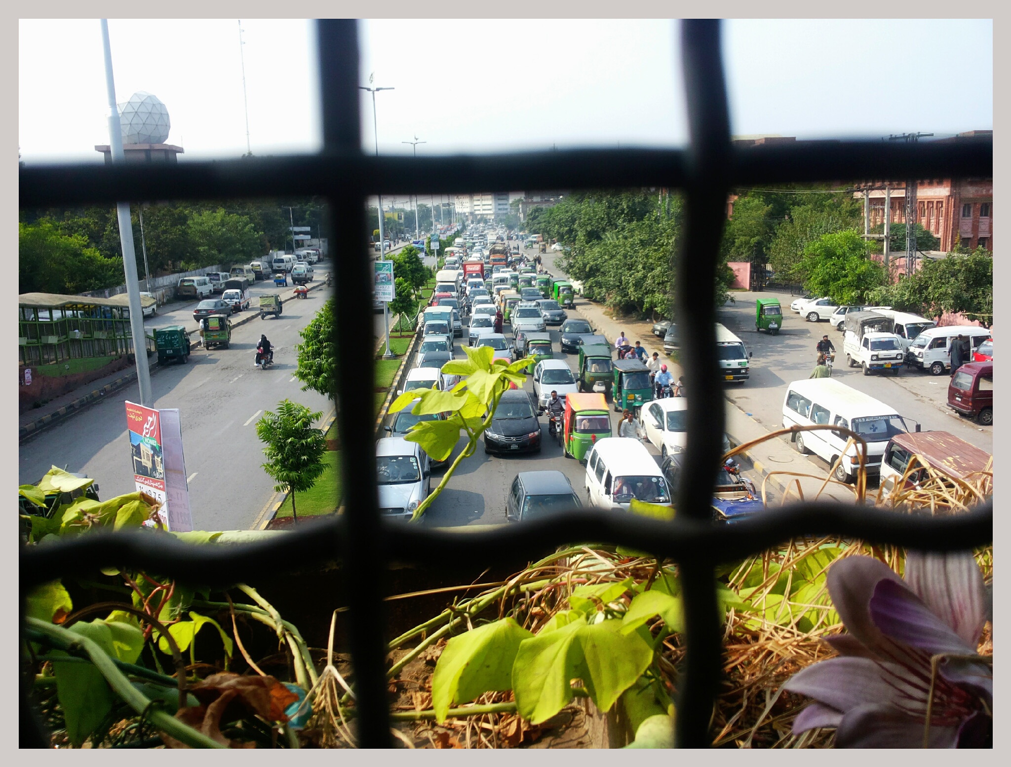
This is the picture of one of the most busiest road in Lahore City. This road is known as Jail Road and is one of the primary road. Behind this road is the residential area. I took this picture from the pedestrian bridge. On the right side of the road is a famous women university of the city named as Lahore College for Women University and on the left side of the road is Meteorological Department of Lahore City. The visible information in the picture is the building block of university, meteorological department building, pedestrian bridge, vehicles passing from the road as well as parked vehicles in the service lane. Moreover the plants, street furniture and advertisement boards. The invisible which can be extracted from the picture is the number of vehicles that pass every day on this road and the number of inhabitants using car or bike as transport. i.e. the volume of various types of traffic (cars, motor cycles, trucks, buses) during the day (e.g., the morning and evening traffic jams) Another invisible information is the air and noise pollution generated by the traffic, and the protection from pollution that the greenery affords the adjacent residential areas. Thus from this picture the knowledge that can be deduced is the car ownership rate is so high in the city. Mostly people drive by themselves and the public transport system is not so effective which cause traffic jams even on the main roads. Thus the data of car ownership and the people using public transport can be collected and used for making the city transport system better in the coming future. [1]: https://edxuploads.s3.amazonaws.com/14151868981993133.jpg