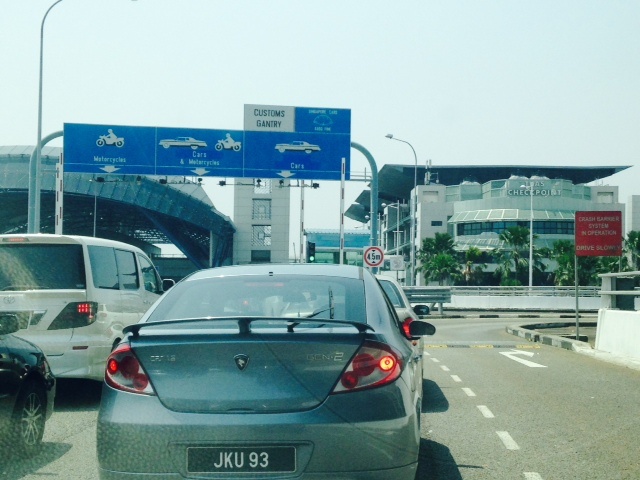
Singapore-Johor Chokepoint
FC-01x Future Cities (1st Run) - Exercise 1 : "Making the Invisible - Visible"

Uploaded on 2014-12-08 by GrantHume
2) Singapore has a population of 5.5 million, & the neighbouring greater Johor Bahru / Iskandar region in Malaysia has a population of 2.5 million, which are connected by 2 land crossings, the western Tuas corridor shown here. Analysis of vehicle and population movement between the two cities/regions is a classic stock and flow, and produces a plethora of data sets and information, including average waiting time, counter utilisation levels, emissions levels, associated direct & opportunity economic costs and health & safelty impacts. This information is only partially visible to the Singapore & Malaysia authorities (who show little sign of co-ordinating their manpower & system planning) & is not visible to travelers who are unable to plan their trips efficiently. Development of the Johor/Iskandar region is severally hampered by this infrastructure choke point, as it discourages the relocation of Singapore commercial activity. 3) This invisible formation can be better utilised in the short term to better manage existing infrastructure assets and optimise traffic flows. In the longer term, it can be used as inputs to more systematic infrastructure solutions which may include high speed rail systems (the slated Singapore to Kuala Lumpur high speed train project), the extension of the Singapore MTR (subway) into Johor via Woodlands, and a possible third land crossing in the east. Tuas land border crossing image. ![enter image description here][1] [1]: https://edxuploads.s3.amazonaws.com/14180633172929505.jpg